
During my broadcasting career, I was very focused on being RIGHT. In this day & age, everything is about being FIRST. I'd rather be correct than being first. Last night, AccuWeather put out their first forecast track despite nothing from NHC. They wanted to be first based on the early model forecasts for Invest 97 L. This morning NHC has started issuing warnings on PTC (Potential Tropical Cyclone) # 9 that will become Hurricane Helene as she reaches the Gulf early on Wednesday.


As you can see, NHC is predicting the landfall somewhere over the Big Bend (again!) of Florida. She will probably become a major Hurricane west of Tampa late Wednesday into Thursday. The initial centerline track has it going between Tallahassee & Perry, Florida. It will not do that as the 5 day cone of error is over 200 miles.


If you have plans to go to the beach later this week, you need to pay attention to see IF the centerline track shifts farther to the west. IF you live in the Tampa Bay area, you will be on the "wet side" of this storm with significant (10-15" rain amounts possible. IF the track shifts farther to the east, wind & surge impacts will increase for you. For New Orleans? We will have no major impacts except higher tides especially along the MS/AL/FL coasts.


Personally, I'm surprised that NHC started issuing warnings before the Recon plane got there. I believe they were influenced by these private weather companies being first. I understand warnings are needed for those land areas in the path of this storm. I just don't like the idea of "gotta be first".
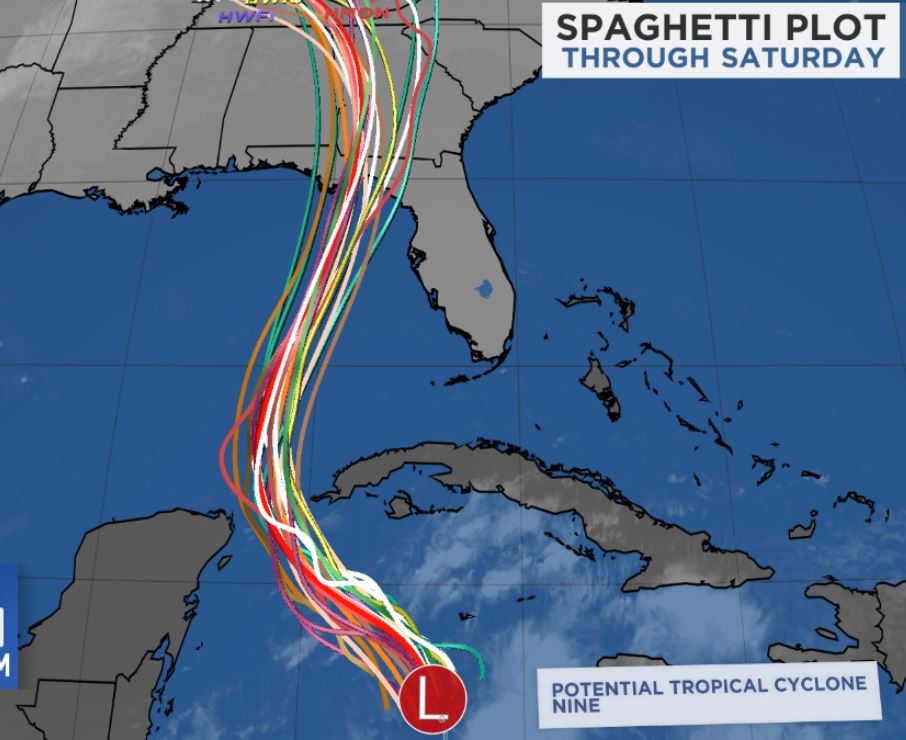
The spaghetti models are all locked in on the Florida Panhandle. What could change that? I'll go into greater details on my usual post around 4 PM. Stay tuned!
No comments:
Post a Comment