
I write this somewhat in a funk after a tough loss to the Eagles. Coulda, Woulda, Shoulda returns! NHC has designated an area off Nicaragua as Invest 97-L. This will allow them to begin running hurricane models based on a location/guess. I don't read much into it and emphasize that yesterday's thinking is still the same. There will be a tropical disturbance in the Gulf for later this week. Let's begin with what we know.


X might mark the spot, but the color satellite view has no organized clusters of storms. In other words, NOTHING has formed yet. I thought our local NWS office has a great graphic on their website.

It's way too early to buy into any model solution. Without a real center location, it's stupid to speculate and/or get nervous. Here's what I can see. The water vapor still has lots of fry air over the Gulf with SW upper shear over the Caribbean.


That should support NHC's thinking that development will be slow for another 2 days. Today's 7 day rainfall totals shifts the heaviest action eastward towards Florida. Yesterday is on top with today on the bottom.


That yellow color is 10-15"+ off of Florida's west coast. Is the shift a trend? Or just a daily flip-flop? Until we have a surface center to follow, I'm not going to show any model solutions. Another thing I do know is a cold front is getting closer as the upper western trough creeps to the east.


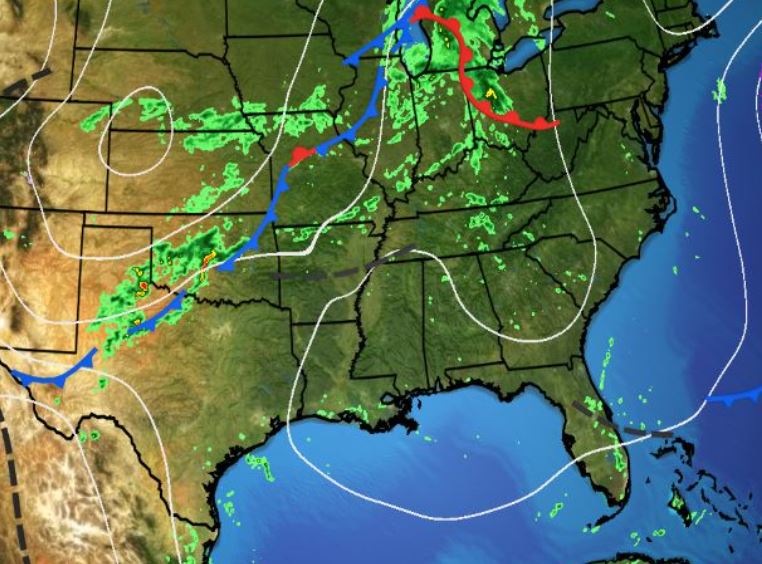

It's sweater weather behind the front! Since we are now in Fall, it's time for cooler temperatures!
.jpg)
IF the tropical disturbance (Helene?) does form and move over the eastern Gulf late this week, the circulation around her could bring in some cooler and drier air? It won't be sweater weather here, but any relief is welcomed. Stay tuned!
No comments:
Post a Comment