
The worst part of Francine is coming ashore as radar views have the center entering southern Terrebonne Parish. Morgan City is in the eyewall with the center headed for Dulac & Cocodrie. Looking at the last NHC forecast centerline, Francine is moving along the extreme right side of the cone. It would take a significant jog to the north for the NHC centerline to be reality.

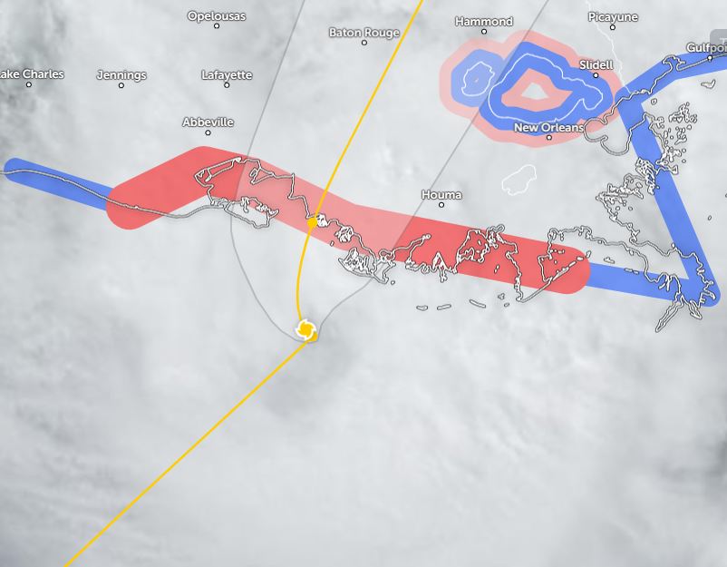
Does it really matter? The track will be inside the cone. We found out during Ida how important any shift in the centerline track makes. That last second jog to the right brought much of Metro NOLA back into the eyewall.


Any shift in the centerline makes huge differences in impacts. Stay to the left, impacts lessen. Stuck on the right side, impacts greatest. Sure it's inside the cone of error, but this shift will bring the centerline/eyewall right over metro NOLA during the next 4-6 hours.


.jpg)
Since radar has Francine's circulation moving over land, one would think NHC would weaken her. Nope, the 4 PM advisory upgraded her to a Cat. 2 with peak winds or 100 mph. Those winds are mainly off the coast as surface locations are less. However, as the center of Francine comes over the city, expect gusts to 60-80 mph this evening. That will cause power outages. There has been a burst of storms (red) on the satellite view as Francine reached our coast.


Things are rocking at my house in Metairie. We will get worse before things get better after 8 PM.

So "hunker down" this evening. Hope power stay up so you can get a good night's sleep. The sun will come out tomorrow! Stay tuned! I'm not even going to mention a new depression way off Africa.
No comments:
Post a Comment