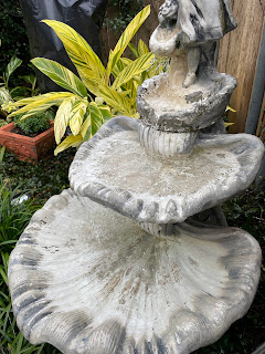
I spent part of my day packing my plants into my He-Shed and covering the heavier potted plants that are too heavy to move anymore. I've also drained my hose & covered my faucets since it appears this cold blast will drop even the South Shore below 28 degrees Monday night & for several nights there after. About the only thing I expect to lose is my variegated ginger plants, but they quickly grow back each year. Here's today's view.
I also have some in ground annuals that should do fine despite the freeze. Thank goodness I have a large shed to bring my plants inside.
What I'll be watching is my bird bath fountain during the freeze.
It should be covered in ice for Tuesday AM. I trust you all have faucet covers? I bought two new ones this year that are way easier to use than the old styrofoam covers.
It appears we'll have to trickle our water late Sunday night into Monday as many locations will dip below 28 degrees. So what has changed since yesterday? Not much. I'm staying with the GFS model that has us on the borderline between rain to our south, mixed (Sleet,snow) across the city and all snow on the North shore. Here's the NWS surface forecast for Tuesday AM.
The dark blue is snow, the orange mixed and the green all rain. Note, all along the Mississippi Coast it's rain. Rather than flip-flopping each day, I'm staying with yesterday's thinking of 3-5"+ on the North Shore and 1-3" for the South Shore. So the question becomes, will we get cold enough and stay cold before the precip arrives? The model forecast of the Polar Vortex is not as aggressive as yesterday, but this certainly is the coldest air we've seen in years. Look at the flow coming out of Canada.
The below zero line is into Montana and the Dakotas. The Arctic cold will arrive here before daybreak and it's heavy coat weather for most of this week.
Remember our 3 key cities to watch. Denver is down to 13, Oklahoma City is 28 with San Antonio still 60+. Today topped 70 locally, but don't get used to it. In fact, the last 10 days were below normal with a brief warm up before our next Arctic blast this week.
It's a fairly safe bet, this January will be well below normal/average.
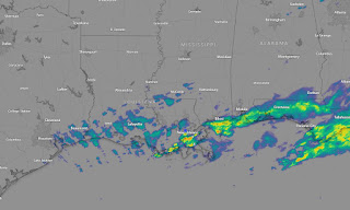
Some showers linger, especially down along the coast. We'll dry out for Sunday & Monday before Tuesday brings us a Winter challenge we often don't see. A Winter Storm Watch is up for Tuesday.
Yeah I know, MLK Day is Monday, but I grab my graphics from Ch. 8. We have no major weather issues for Sunday IF you're dressed for the chill. Monday will have freeze issues with Tuesday into Wednesday our days to pay attention. Stay tuned!


No comments:
Post a Comment