If you're on the internet a lot (Face Book, Twitter, Instagram etc), you have seen the chatter about the severe cold outbreak coming for the third week in January. Granted, it's going to stay below normal/average for most of this month. However, I'm not convinced yet that it will be as bad as models suggest. Let me explain by starting with our current upper pattern.
A lobe of the Polar Vortex is over Hudson Bay with a straight shot of cold air pouring down into the northern Plains. But is that air coming here? I mentioned yesterday the core of the cold will stay to our north & east. Here's why.
Clearly, the first lobe of the PV does not plunge southward but shifts NE of Maine by Wednesday PM with a WSW flow over us. That is why the next 3 days will be chilly, but not frigid. But the internet chatter is for next week. Here's the upper air valid for Saturday.
The next lobe does establish a broad & deep upper trough over the eastern 2/3rd of the country that will bring down the Arctic air. But the Polar Vortex does not keep diving over the Great Lakes IF you believe the GFS model. Below is the upper flow for next Wednesday with the trough remaining, but the Polar Vortex has lifted back northward.
In addition, Canada & Alaska are not that cold. In fact, look at Alaska where nobody is below zero. IF the Polar Vortex is to form next week, those northern temps have to decrease. Favoring the coming cold is the current snow cover.
It's pretty impressive on satellite views, but the coming late week warmth will eat much of that away. So I'll be watching IF the sub-zero cold rebuilds or comes over from Russia & Siberia where there is 40-50 degrees below zero.
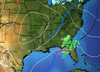
Back over the U.S., things are quiet for now. This morning's low clouds have pushed down over the Gulf, but are likely to return by late Wednesday.
Models are hinting another weak Gulf wave will bring back some showers on Thursday. Most of the rain should stay offshore.
Many locations topped 60 degrees today for the first time in a week. Still for MSY it was day 8 below normal/average. As you can see, the warm up late week will be brief as the Arctic blast arrives late Sunday. It could bring a hard freeze to the North Shore and a moderate freeze south of Lake. Pontchartrain. Plenty of days to watch it before we have to do anything. Finally...
My wife's (Brenda) painting was featured on the December/January cover of Inside New Orleans. You can come join us this Thursday to celebrate the magazine's 10th anniversary at Degas Gallery, 3909 Magazine Street between 6-8 PM. We're popping some bubbly along with some treats and showcasing some of Brenda's art work.. Weather will be perfect! Stay tuned!


.jpg)
.jpg)


No comments:
Post a Comment