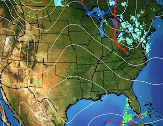
I enjoyed watching Bruce Katz last night as he laid out the various scenarios that could happen with the coming cold blast. As he explained, confidence is HIGH that Arctic cold is coming with several mornings next week that will have freeze issues. However, he explained at 5-7 days out, confidence was LOW that any snow/ice problems would develop for us. Today's models have confirmed that low confidence as the trends have been for drier conditions behind the Arctic front with no overrunning precipitation. So the first question should be How cold will it get? First off, the upper pattern must change as we still have a mainly west to east flow across the southern states.
The Polar Vortex is centered way north of Hudson Bay where the air is 20-30 below. So let's track the model forecast for that Vortex beginning with Saturday morning. As you can see, the Vortex starts to move southward.
By Monday morning, the Vortex has sunk to just north of Lake Superior. Notice the flow to its west is straight out of the North Pole and that is why confidence is high that the bitter, freezing cold is coming. So why is the chance for snow so low? Look at the "AXIS" of the upper trough for Wednesday morning.
It has pushed to the Northeast with a NW upper flow over us. For us to get snow once we're in the cold air we need an upper SW flow. Geez, just watched TWC showing all the model solutions for snow and it was almost comical. C'mon, just say model solutions have conflicting information. I try to show you why (IF the GFS model is correct) we will get cold, but we won't see much, if any, frozen stuff. Don't try to just hype your ratings by giving the snow geeks hope. It may snow here & I might win the Powerball tonight! So back to the cold. Where is it? Not over the lower 48 as Denver is in the mid 50s with even Montana in the 40s!
The Super cold (50-60 below zero) remains over Russia & Siberia with no signs yet coming across the Pole. Northeast Canada does have some cold (20-30 below) and that is what will begin coming southward with the Polar Vortex.
For the freeze to reach us, it has to get much colder in the states to our north. What I have seen is the melting of the snow cover across Oklahoma, Arkansas & Tennessee.
I'll be watching cities like Denver, Oklahoma City & San Antonio as an indicator of how cold will we get? Whatever the severity is, it's pretty certain the duration will cover most of next week.
I pretty much agree with the FOX 8 numbers. 18-22 for the North Shore means a hard freeze with full precautions Sunday night through Thursday. 28-33 for the South Shore hopefully means we will have no pipe issues, but those numbers could go lower. In the short term, we have a nice Friday & Saturday ahead with a Spring preview.
We could see a few showers early on Saturday. All my plants are outside enjoying the milder weather. I'll make the move into my heated shed on Saturday. Finally, what a wonderful evening to visit 3909 Magazine Street (Degas Gallery) between 6-8 PM and see some of my wife's artwork. I'll be there sipping some bubbly & tasting some snacks. Come by and say hi. Stay tuned!


No comments:
Post a Comment