
I showed you yesterday how I covered my plants as computer models predicted 23-27 for the North Shore and 28-32 for the South Shore. My personal feelings thought the north winds would provide the South Shore some moderation of temps to keep us above freezing, but I suggested we not take the chance that models were wrong. Reality has models being right on with little Lake P. influence. Slidell dropped to 27 degrees with MSY 29. Not records, but close. So what happened?


Northerly winds over night never slackened staying 15-25 mph. That did not allow much moderation as the air wasn't over the Lake long enough. In fact, at 2 PM, winds are still 15-25 mph.

.jpg)
At mid-day, there is no Lake Effect with both sides mainly in the 40s. This is a large Arctic airmass that has sagged all the way to the Yucatan. It will take several days for it to finally pull away allowing a real warm-up for next week.


It's still in the 30s across south Texas and as the cloud cover spreads back over us, the next 3 days will continue the current below-normal trend.


The center of the current Polar Vortex is right where the model predicted, Ohio, It will keep shifting to the NE allowing for a slow warming trend.
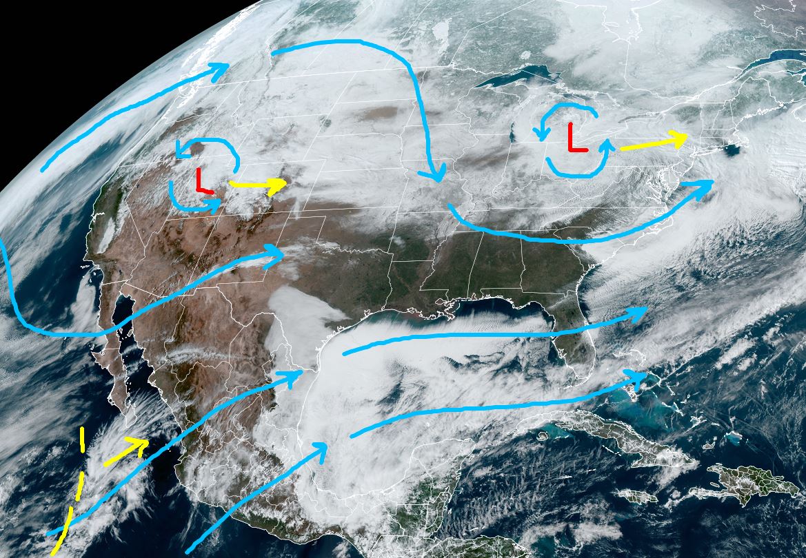

Parades & Family Gras in Metairie tomorrow night & Saturday will be dry, but quite chilly. A rain threat arrives late Saturday evening into midday on Sunday with another upper disturbance (yellow dashed lines) coming out of the Southwest.

So we can expect similar morning lows on Friday with full precautions for the North Shore and away from the Lake south. With all of the focus on temperatures, I haven't read anything about the rising Mississippi River. With all of the rainfall in the past 10-14 days farther to our north, the River has jumped up nearing flood stage in some locations. The Carrollton Gauge is up over 10 feet and will approach 13 feet during the next 2 weeks. The snow cover stands out on satellite views as you can easily see the rivers.


Expect to start seeing stories on River restrictions once it rises past 11 feet. What we don't want is another heavy rain system on top of the deep snow pack. No concerns locally since we are protected by 20-foot levees. However, IF River Forecasts project levels 17'+. the Army Corps will think about opening the Spillway again. Something to watch. Stay tuned!
No comments:
Post a Comment