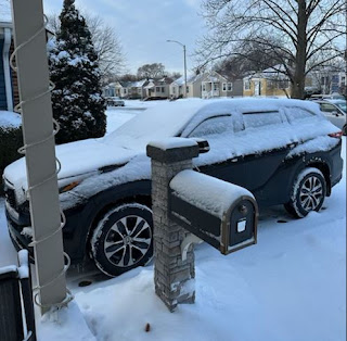
While I was on the golf course yesterday during our record 83-degree warmth, my youngest sister (Carol) sent me these views from Whiting, Indiana. We have had more snow here (8-10") than what they have had this winter! Like our snow, it looks pretty right after it falls. But, if you have to get off to work or travel, it'll take you 10 minutes just to clear off the car windows.
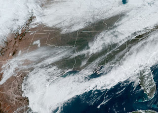
That same snow system left quite a snow cover from KS/OK into the Great Lakes. On satellite views, you can tell the snow from the clouds by seeing the river features.
The snow cover is making air temperatures quite chilly. But that air is NOT coming down to us even though the surface front has pushed deep into the Gulf.
This front has brought an end to our 3-week warm cycle. Remember the 3-week cold cycle with the snow?
I don't expect a return to the deep freeze we experienced in January, but the next 10 days overall should be below normal/average. Our current cooldown won't last. An upper storm slamming into California will streak eastward tomorrow and Saturday causing the front to rapidly return northward as a warm front. In fact, we'll jump back into the warm sector by Saturday.
The bottom graphic is valid for 7 PM on Saturday. The red-shaded area is where some severe storms could erupt. SPC already has placed a level 3 severe threat for Saturday.
Clearly, SPC expects the greatest threat is to our north, much like yesterday's storms. A tornado was spotted in Columbia, MS causing property damage. We'll have a better view regarding the severe threat by Friday PM. For now, we'll just see increasing clouds on Friday as the upper SW flow overruns the surface front.
That upper SW flow will keep the core of the Arctic chill well north of us. At the surface, much cooler & drier air has replaced the muggies of yesterday. Our dew points were in the 70s yesterday compared to the 40s today.
Today's temps are 20-25 degrees colder than the same time yesterday. Add in the 15-20 + mph winds and it feels chilly outside without a coat. It's only a 2-day cooldown as Saturday will be back to 80+.
As many of you know, I use the FOX 8 weather graphics. For some reason, the new 7 day is not updating until after 5 PM. The above is from their noon broadcast. It will be colder next week and I might have to bring my more sensitive tropical plants back into my heated He-Shed. Too soon to make that call. Stay tuned!


No comments:
Post a Comment