
I was going to point out that models are not indicating any Tropical Development in the next 7-10 days, and that would get us through June with no named storms. The average/normal date for the first name is June 20th, so we are slightly behind climatology. However, this afternoon, NHC put out their TWO (Tropical Weather Outlook that highlights an area of low pressure in the central Atlantic that could show some development.


The tighter satellite view clearly shows a swirl of clouds, but there are no T-Storms developing around it as it drifts to the NE. To me? NHC Specialists are bored and need something to talk about. Just a quick glance at past records indicates that a slow start to the Hurricane Season doesn't mean a below-average season. In 2004, the 1st named storm didn't happen until July, yet the season still had 15 named storms. We all know the heart of the Hurricane Season is August-September and the first 2 weeks in October. The switch can turn on in a hurry, but there are no signs of that yet. Plenty of Saharan Dust covers the eastern Atlantic.


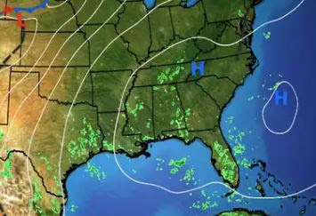
All those wispy clouds over the Caribbean tell me there is a lot of westerly upper shear that will prevent any development. The only two stories over the nation are the western cold under the upper low and the heat under the upper ridge from the Rockies to the East coast.


While the West needs sweaters and jackets, the states east of Denver are miserable as dew points in the 70s make the heat feel much worse.


For us, it's pretty much basic summertime. We're always hot & humid with spotty storms. The location and rain chances may shift day to day, but until October, get used to it.


So I guess we need to place your bets on NHC. Will they name the Atlantic swirl Andrea during the next 2-3 days? Stay tuned!
No comments:
Post a Comment