
I was away attending my 60th High School reunion back up in Northwest Indiana this past weekend. What a hoot meeting old friends and one very lovely new friend. Amazing, you can go to school for 4 years and never meet. Then 60 years later, magic strikes. Bishop Noll Institute was not a fun time in my life, but this reunion was!


Another highlight of this weekend was getting back to da sliders.


I haven't tried Drew Brees' sliders yet, but I will to see if they're as good. While I was gone, Barry was named in the southern Gulf. Unlike Andrea, this is not a wasted name since he did affect land areas. Barry is long gone, and all the action remains in the EPAC.


Hurricane Flossie is nearing a Cat. 3 with 110 mph sustained winds. She's predicted to remain off the coast and weakened. The Atlantic is dead until the Saharan Dust leaves.


The dust usually begins to settle down by early August, but for now, the Atlantic is dead. There is an area from the eastern Gulf into the Atlantic that NHC gives a 30% chance for development.


Right now, all the clusters of storms are due to an upper air system. Typically, upper features take a long time to develop down at the surface, and this is a complex upper system.


WPC's 7-day rainfall totals have shifted eastward, indicating any surface development will be EAST of Florida, keeping us on the dry side for this weekend.


IF a surface low starts to develop to our east this weekend, look for that frontal boundary just to our north to sag southward. No, we won't get cooler air, but we could see drier/lower dew points by Thursday through Sunday. That will result in lower rain chances and hotter temps.


Get some rain, you receive cooling relief. No rain, da heat is on!

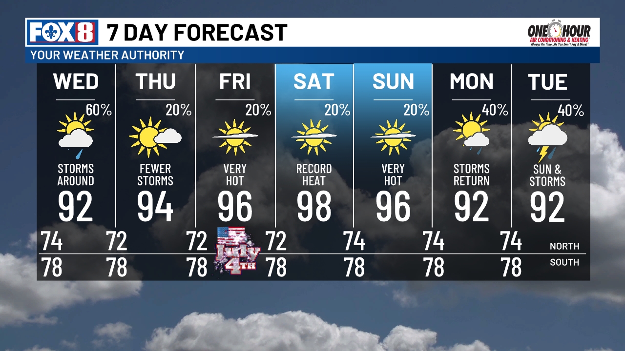
Again, IF anything starts to develop over the northeast Gulf or east of Florida, we will be on the DRY & Hot side through the weekend. It's the usual common-sense precautions with our summer heat. Glad to be back, Gang! Stay tuned!
No comments:
Post a Comment