Visible satellite loops are showing a well defined low level circulation over the SW Gulf and NHC is only waiting for Recon to confirm we have our next named (Nestor) storm. They will call it "sub-tropical" as it will not be a fully warm core system. Rather, it's structure will be more like a winter-time (cold core) storm. That typically means rainfall won't be as heavy and winds will be less than a hurricane. NHC has issued their first track that keeps it well offshore from the mouth of the River.
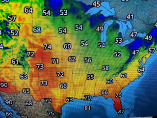
The current centerline track has it just west of Panama City. It will be interesting to follow how that centerline shifts during the next 2 days. The farther to the east, the less impacts for us. RIGHT NOW, the only impacts (high tides, gusty winds) appear to be confined to coastal locations. There are several things working against development, mainly wind shear caused by an upper low over central Texas and cooler surface air that had the North Shore in the 50s this AM with 60s all the way down to the coast. Unlike August & September hurricanes that often move very slowly, future Nestor will be a rapid mover limiting the heavy rainfall potential to areas east of the centerline track.
When NHC comes out with their next update at 4 PM, check on that centerline track forecast and see if it's "trending" farther to the east or back to the west. As I posted last night, we will be on the dry side of this system and may see no rain at all. That would be great news for all the festivals/Fairs/Football games scheduled this week. I'll update later tonight. Stay tuned!


No comments:
Post a Comment