Seems everyone is talking about today's abrupt cool down that forced us back into our Winter weather gear. The good news is the core of the bitter cold over central Canada (25-30 below) will dip across the northern tier of the U.S., but it is NOT coming down into the Gulf South.
It took much of the day for the clouds to clear the city, but you can see they remain along the coast to our south. A weak low will form over the southern Gulf for Thursday forcing those clouds back over us into Friday. Most of any rainfall should stay south of NOLA, but the clouds will make for another chilly day.
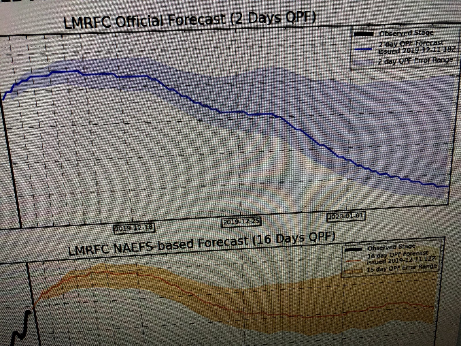
The weekend should see a rapid warm up back to 70+ for Sunday and Monday before our next front plows through late Monday into early Tuesday. Lost in all of the chilly details is the Mississippi River has once again surged back to near 12 feet. Remember that happened last year, but the high water levels never dropped all the way through Spring into early Summer. That is not expected to repeat as the River Forecast Center indicates a quick drop-off in River levels for the last 2 weeks of December.
Let hope we don't see any major rain/snow storms up north that might change the current forecast. Stay tuned!


No comments:
Post a Comment