We all remember last Winter when the high water (above 11 ft. at Carrollton gage) arrived in November and didn't leave until July. The Spillway had to be opened twice to lower the water heights that were predicted to top 17 feet. So far this Winter, that hasn't happened...yet. The recent heavy rains up over the Ohio Valley are sending a surge of rising water down towards us. Today's River Level of 10.5' is forecasted to top 12-13 ft. during the next 10-14 days. What we don't want to see is more rain up north that could keep those levels up the rest of this Winter. Typically our high water levels happen with the northern snow melt in March-April into May. Hopefully, after this current surge passes, we'll see the River return back to levels below 10 feet before that Spring melt occurs.
What a difference from Friday's gloomy skies as bright sunshine energized us this morning and that'll be the case again on Sunday & Monday.
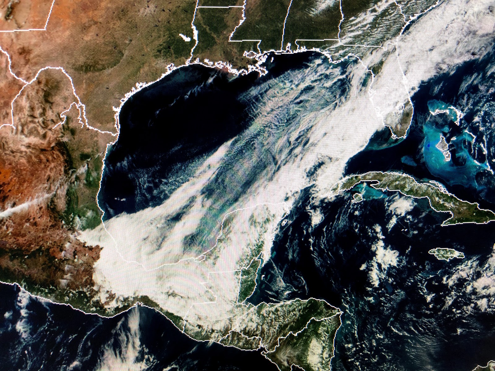
As you can see, the cold front has swept the clouds way down over the western Gulf as much lower humidity has replaced the muggies. Temperatures are comfy cool with sunshine, but with clear skies and light winds, you may want to protect your tender plants for the next 2 mornings with many areas getting down to near freezing.
I still don't see any Arctic cold plunging our way for at least another 7-10 days, but there remains plenty of brutal cold (30-40 below zero+) lurking just north in Canada and Alaska. I suspect some of that could reach us later this month into February.
In the meantime, we focus on tomorrow's big game in the Dome. I see where most experts expect a low scoring game, but I'm sticking to my gut that tells me Drew is clicking and Sean is going to ride that horse into the Super Bowl. Saints 42, Vikings 24. Who Dat! Stay tuned!


No comments:
Post a Comment