This morning I posted snow pictures from my son's house in Edmund, OK. The day before, snow fell at my oldest son's house in Longmont, CO.
The difference is the skies in Colorado cleared while those in Oklahoma remain cloudy. With clear skies and a fresh snow cover, Longmont dipped to 7 below for their morning low. The air mass that is coming here for Thursday & Friday is very cold, but it is NOT tapping the bitter Arctic cold lingering up in Canada.
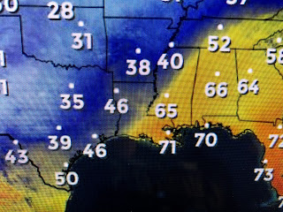
We will see our highs on Thursday way before daybreak with daytime highs falling into the 40s requiring us to bring out the heavy coats again. Until the upper trough, now over the Rio Grande, passes early on Friday, we'll remain cloudy & cold with sunshine coming back for Friday PM & the weekend. Our severe threat has lifted to the NE as you can see on the Water Vapor pix. The brighter(colder) cloud tops (blues & reds) are well to our north and east with another lobe swinging up from the Gulf off lower Texas. That will spread some heavy rain back over us after midnight and should make for a wet, difficult morning drive.


As has been the case for most of this Winter, the upper trough will quickly pull away to the NE and not dig down into the Gulf. The result will be a short lived cold spell that could bring a light freeze to the North Shore on Friday before a big warm up returns over the weekend into next week. You cold weather lovers better bask in the chill as it will not last very long. Stay tuned!


No comments:
Post a Comment