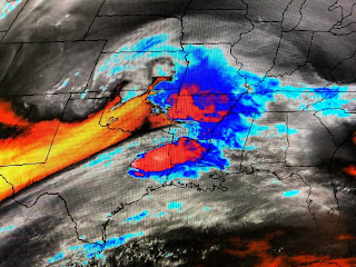
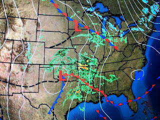
SPC (Storm Prediction Center) has not made any major changes to their thinking regarding another outbreak of severe weather. In fact, the graphics I showed you yesterday are almost identical.
Today's bullseye severe weather threat is to our west and north that shifts right over us for tonight and is east of us on Thursday.
The current Tornado Watch is right where all the action is this afternoon. Like our past weekend storms, these contain lots of lightning.
The upper energy on Water Vapor & Satellite pics is over north Texas and western Oklahoma with a surface low just west of OKC. The storms currently in Texas and north Louisiana will slide to our north and our severe weather threat (if we have one) won't come until late tonight into midday on Thursday. If it's like the last system, the severe threat could develop along the tail/western end of a line of strong storms.
Winds ahead of the cold front and developing surface low are cranking from the SSE at 15-25 with gusts to 30+. I may go into my yard and bring down my hanging planters this afternoon. Let's keep up on the weather this evening, over night into midday on Thursday. Check with FOX 8 to see the timing the models are forecasting, and make sure you have the FOX 8 weather app ready to go. Behind this front we'll have several very nice days of lower humidity and comfy warm temps. Stay tuned!


No comments:
Post a Comment