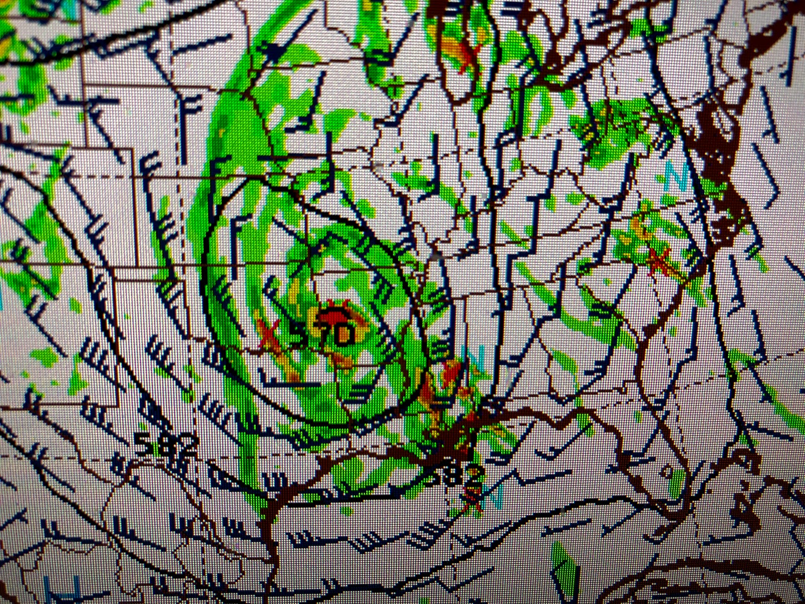
There has been no major changes to the thinking that an upper air low pressure center will "cut off" from the main jet stream and stall near the AR/LA/TX border on Wednesday. This would put us in the prime location for some heavy downpours as indicated by models.
The top pic is the computer model with the upper low while the bottom two are the projected rain totals (3-5") for the next 5 days. The greatest chances for heavy rainfall looks to be on Wednesday into early Thursday.
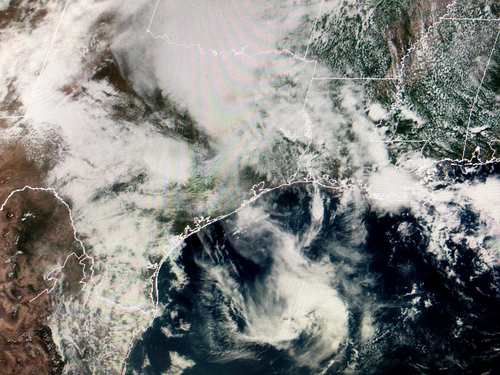
The current surface map has no fronts around with almost hot temps where it's not raining and near chilly (60s & 70s) underneath the clouds and showers. Rainfall is enhanced by small upper lows and there are many on our Satellite view.
Florida is cloud covered with several mid level swirls providing widespread shower activity. There is an upper swirl over east Texas with a weakening swirl down over the Gulf south of Lake Charles.
Finally, closer to home we have a blob SW of NOLA with two lines of showers/T-Storms moving into over Breton Sound. Some lightning accompanies these storms and the atmosphere is ripe for a coastal waterspout or two. Keep the umbrellas handy for the next 2-3 days.
I finish with pictures of my growing Grandson Ethan and his 2 best friends (besides Mom & Dad ! ). Hopefully many of you are with family on this holiday where we honor those who serve or have served our great country. To my fellow Marines, Semper Fi ! Stay tuned!


1 comment:
So happy for you and your service.Thanks.
Post a Comment