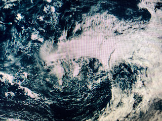
NHC is giving this system a moderate (50%) chance for developing into a sub-tropical Depression later tonight or on Saturday. If they name it, he'll be called Cristobal.
On the surface weather map, a weak cold front is trying to stagger down to the Gulf Coast. yesterday's upper low is barely visible as the brighter clouds over NE Louisiana and that energy is lifting to the NE along the cold front. That front will slowly bring in drier air over the weekend and that dry pattern will last through next Tuesday.
The top graphic shows the lower dew points (drier air) to our west and north. We should really feel that chance by Sunday. A few showers popped up today, but they have been mainly south of NOLA.
Finally, models continue to hint something could develop in the Gulf during the second week of June. RIGHT NOW, there is nothing there except a leftover cluster of storms weakening over the SW Gulf. On the Pacific side, you can see a weak spin in the clouds that is given a high (70%+) chance for development this weekend. Hurricane Season begins here on Monday and FOX 8 has their annual Hurricane Special, Weather the Storm 2020 Monday evening at 6 PM. I'll talk more about preparedness next week, but for now, let's enjoy this quiet weekend. Stay tuned!


1 comment:
Thanks. Bob. Sure miss you on TV.but glad you are here. Keep us free from Hurricanes. Couldn’t deal with that and the virus. 😂
Post a Comment