


Last night's cold front has pushed off our coast and a surface area of low pressure is trying to form just SE of Brownsville. It's not likely to develop since the upper energy is down over the Bay of Campeche where the lightning is concentrated.. In addition, cooler and much drier air is being drawn offshore making the situation more like a winter-time scenario.


Since clouds are lingering well behind the front, our highs are likely to remain in the 60s all afternoon. The upper feature may trigger weak surface development tomorrow as it approaches Florida, but the upper winds are way too strong for any tropical development. It will bring much needed rainfall to south Florida.


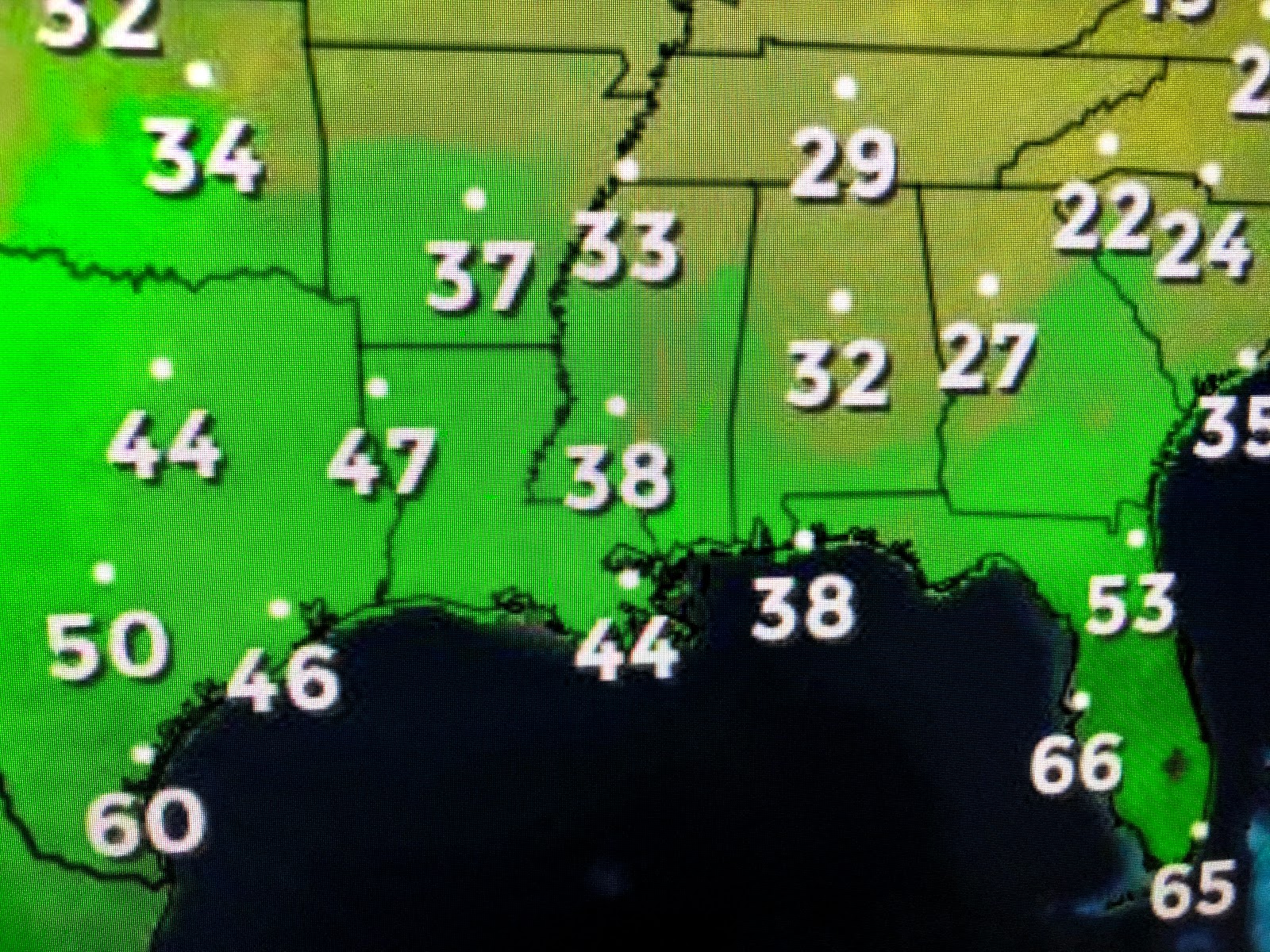
The other big weather news is the record cold over the Great Lakes and Northeast. The blue-ish colors indicate snow is falling on May 9th! Another surge of cold is following the next clipper system now in the Dakotas. It will re-enforce our delightful weather of cool-mild days and almost chilly nights through next Tuesday. Long range, the heat and humidity will return for us by late next week so get out and enjoy this late season chill as it won't be back until late October.

Many of you were correct guessing this young, handsome man is Ron Swoboda, World Series Hero of the 1969 New York Mets and Ch. 8's Sports Director back in the 80s. He's one of my golfing partners and sometimes his athletic ability still shows up! Enjoy your weekend and stay tuned!
No comments:
Post a Comment