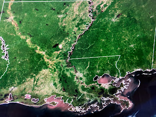
As we near the mid point of June, I'm thinking so far this Summer, it hasn't been that bad. Now technically, astronomical Summer doesn't begin until next Saturday June 20th, but in past years I remember being sick of the heat already. We have been fortunate to have several late season fronts come through giving us breaks from the heat and humidity. I mentioned yesterday that it is a rare summer day when we don't have any storms around. Today was so clear that you could still see the muddy flow of the Mississippi River into Lakes Pontchartrain & Borgne and also out of "Mardi Pass", the cut made on the east side of the river around Pointe a la Hanche.
The Florida beaches had some clouds, but the real storms were farther to the east.
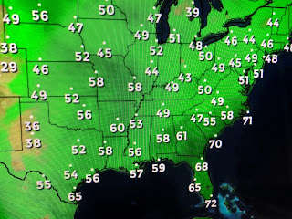
A large high covers most of the eastern states and yesterday's front has pushed to the east coast with the western end "washing out" across the central Gulf. Another surge of cooler,drier air is sweeping southward over the Great Lakes where today's highs stayed in the 60s & 70s. We'll slowly see a return in our low level moisture (humidity) and highs should creep back into the lower 90s, but all in all, this last weekend of Spring should be a good one for outdoor activities. Our dew points in the 50s mean our night time lows will easily drop into the 60s on the North Shore and away from Lake P, south. Some clouds may return over the weekend, but no rain is in our forecast into next week.
If you plan on being outside, make sure you dress like Ethan with eye protection and a hat covering. Say goodbye to Spring and get ready for you know what's coming for the next 3 months! Enjoy your weekend & stay tuned!


No comments:
Post a Comment