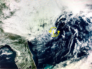
Area # 1 is off the Carolina coast and it does has a low level swirl of clouds. Upper winds appear too strong for anything to get going, plus it is too close to the coast and will run out of time. Area # 2 is approaching Trinidad and the African dust spilling out into the Atlantic will hinder any development with that system in addition to it running into South America,
On the water vapor upper air map, the cut off low is centered over the Carolinas and we remain on the dry side of this system. The dry air has cleared the Gulf of clouds and the next 2-3 days here look mostly dry.
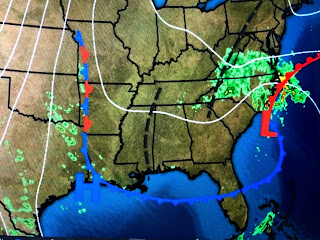
Anytime the surface weather map has a bunch of black lines & fronts on it, it's telling you there are boundaries around, but the boundaries usually are not temperature boundaries, but rather moisture boundaries. The 50s dew points have spread down to the North Shore and that should be the case again tomorrow. That means, over night temps should drop into the 60s north and away from Lake P with afternoon highs back into the lower 90s. Kind of neat to see how cool it is under that upper low with Asheville only in the lower 60s this afternoon. Not so lucky here and you'll need to pay attention to staying hydrated as usual if you plan any outside activities for the rest of this summer. None of the computer models are hinting at tropical development for the next 10-14 days. Stay tuned!


3 comments:
Blah blah blah is it even possible for you to post without bashing any weather organization? Seriously it’s old.
Keep up the good work Bob! Big weather organizations obviously have agendas. Name every swirl...don't address obviously faulty high temp readings at MSY etc. Call them out when you see it! Thanks.
So what would be the “agenda” of the NHC?
Post a Comment