A friend of mine posted this on Facebook. It shows how weak these first 5 storms have been this year compared to our horror year of 2005. Will this weak trend continue this year? Probably not as the strongest storms are almost always in the heart of the season, August & September. But before you start jumping on the AGW bandwagon, remember it's the development in satellite technology that allows NHC to classify small systems sooner than in the past.
So Fay is likely to be named tomorrow or on Friday and move along the NE coast as a Tropical Storm bringing much needed rainfall to areas that are in drought. Hope you are not planning a trip to Philly, NYC or Boston Friday through Sunday? They will have a nasty weekend. It's a different story here.
That old frontal boundary has finally lifted to our north and east taking the rains with it. Doesn't mean we can't pop a stray storm during daytime heating but coverage should be no more than 20%.
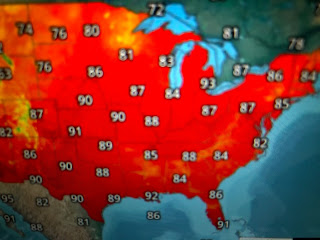
With the boundary gone and an upper high building in for the next 5 days, expect HEAT WAVE locally with daily heat advisories. Notice the 70+ dew points cover most of the eastern states all the way into New England. They are feeling what we feel every day for 4 months. Misery does love company, but they do get summer cool fronts that bring temporary relief, unlike us. If you really want cooling relief, head out west to places like Crested Butte (Hello Dr. Don), or Missoula or Boise. You even need a sweater there at night! Stay tuned!


No comments:
Post a Comment