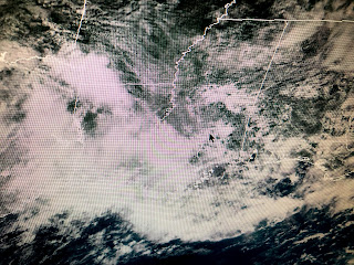
We have a stalled old frontal boundary stretching from Texas to Georgia with several swirls of low pressure moving along it. Until that boundary lifts away or dissipates, our rain chances will stay way above normal with the threat for more flooding.
NHC is indicating the swirl over Georgia could become our next named storm (Fay) later this week off the Carolina coast.
In case you're wondering what happened to the "E" storm, NHC did name it way out in the Atlantic as it races over open water. Stayed tuned!


No comments:
Post a Comment