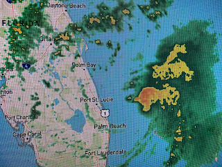
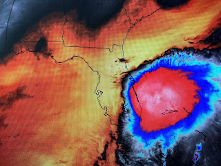
Satellite views this morning show Tropical Storm Isaias looking more like a Hurricane than when it was a hurricane! There is a circular mass of clouds, however,Recon and radar data confirm he remains a very lopsided system.
The heaviest rains & winds are far offshore so it appears Florida will come through this threat with minimal impacts. The center line track forecast keeps the core off the coast and lots of dry air and increasing wind shear should mean any strengthening will be brief.
So the next land areas to be threaten are the Carolinas and then the states farther to the NE, Their main concern will be heavy rainfall (5-8") that could cause real travel problems.
NHC is watching another area that could become the next named storm (Josephine) sometime in the next 3-4 days. For the Gulf, there is nothing showing up for the next 7-10 days.
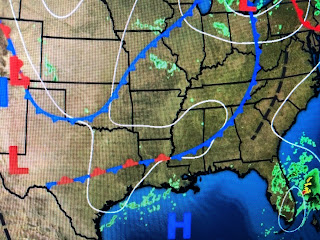
Locally, I'm still hopeful that the frontal boundary to our NW begins staggering southward once Isaias gets to our latitude (30 north). Don't look for cooler air, just lower humidity that should make the nights feel better. Some showers are developing to our west for today and that should provide relief from our 90+ heat. Stay tuned!


1 comment:
Thank you!
Post a Comment