I'm posting before the 4 PM NHC update, but based on satellite loops, I expect TD 11 to be upgraded shortly. If not at 4 PM then perhaps by 10 pm.
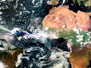
The top photo shows several waves moving west over Africa with TD 11 in the central Atlantic. On the moving satellite loop, you can see a better defined circulation with the bigger storms on the west and north sides and not much south & north. The reason this system will never be our worry continues to be based on the predicted deep upper air trough that will form over the eastern states and Gulf for next week.
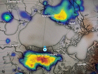
The top graphics is the Wednesday morning placement of the trough for next Wednesday. Note all the west winds over the Gulf. That is part of the reason NHC's track curves it to the north well east of the U.S. This will not be our storm. Locally, we do have some cooling storms around that are slow movers causing some street flooding.
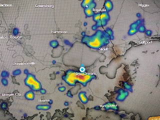
We have several clusters of storms along the coast, building inland around NOLA and along cluster around SHV. Where it's raining, temperatures are 10-15 degrees cooler.
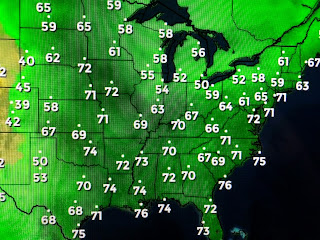
The surface map is the same oh same oh. North of the front you can see the lower dew points and good feel air. IF that east coast trough forms, it might bring us some drier air for next Tuesday and Wednesday? That would be nice! We'd still be hot.
Finally, besides TD 11 (Josephine), the Gulf, Caribbean & Atlantic have no systems that look likely to develop for the next 5-7 days. Stay tuned!


No comments:
Post a Comment