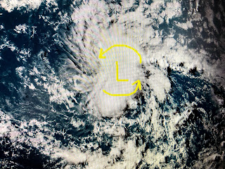
As mentioned on my last post, NHC increased the chances for development out in the Atlantic to 90%, so it should come as no surprise that we have Tropical Depression # 11 this afternoon. According to the intensity forecast, NHC will name it Tropical Storm Josephine later tonight or tomorrow.
Early computer model tracks curve TD 11 north of the Islands lessening the threat on it reaching the Gulf, In addition, another unusually deep upper trough is expected to plunge down over the eastern states next week. That should curve whatever forms to the north so this should not be a storm we need to worry about.
The top graphic is the upper flow for next Thursday which has strong shear over the northern Gulf. The rest of the Tropics look quiet except for a small swirl just off the coast SE of Charleston. None of the models develop this. Locally, it's basic Summertime over the South.
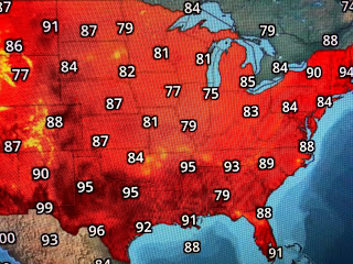
Look at the dew points behind the front near St. Louis. The DP there is 71 while behind the front they're in the 50s with a good dry air feel. In another 5=6 week we might start to see real cold fronts getting closer to us. There's still a lot of heat left!
A few storms have bubbled up during daytime heating but most of us have stayed dry. There is a lot of dry air showing up on water vapor, and until that boundary shifts away, our rain chances should stay below normal. Stay tuned!


No comments:
Post a Comment