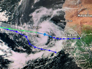
Based on satellite views, TD 18 actually has a better look than Tropical Storm Paulette. Since both are so far out where Recon can't reach them, NHC uses a polar orbiting satellite to determine wind speeds. It won't be long before Rene arrives.
NHC still is highlighting an area along the East Coast, and satellite loops do show several small swirls. Bottom line...it's on the other side of Florida and NOT in the Gulf.
You can see there are lots of disorganized clusters of storms off the East Coast, south of Cuba and along the western Gulf, but none shows signs of development. To me that's because the MJO has shifted back into the unfavorable (sinking air) phase. When Laura was rapidly developing, the MJO was in the favorable (rising air) phase. I have come to believe the MJO has a much greater impact on storm formation than many give it credit. See today's story in The Advocate.
There was much discussion about what caused Laura's rapid intensification, but not one mention of the MJO (Madden-Julian Oscillation). If we can stay in the unfavorable phase for another 2-3 weeks, that gets us almost to October and more cold fronts. Speaking of fronts...
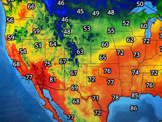
The cold air is moving out of Canada into the northern Rockies and will bring an end to the growing season across the northern plains. The question remains...how far south does the front go? Based on what the models now show for later this week, this front is NOT going to bring us any relief. In fact, look at our dew points that have returned into the 70s as the good feel air retreats to the NE.
Remember it takes a trough over the eastern states for a cold front to head down towards us. The above graphic is the upper (18,000 ft) air forecast map for Thursday morning that has the trough lifting out back into Canada leaving a "cut off low" back over the Rockies. That's where the cold air goes. It now looks like we'll stay very summer-like for the next 7-10 days.
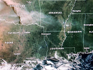
The western fires remain impressive on satellite views with one in SE Colorado/western Kansas producing a huge plume across Oklahoma. We might even see some smoke here to add color to tonight's sunset?
Finally, September is National Childhood Cancer Awareness month. Brenda & I are passionate supporters of CAPS FOR KIDS, a national non-profit for children battling cancer, that is based in New Orleans and serves over 150 pediatric oncology hospitals nationwide. Their big fundraiser is this month called "Give a High Five" where you can donate $5 (or more) to help Caps for Kids connect more children battling cancer with their "Cap Hero". If you can help out, click the link below.
https://capsforkids.kindful.com/?campaign=1030521
Brenda & I appreciate your time and support...and so do the children!
Next update later today. Stay tuned!


No comments:
Post a Comment