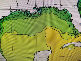
You can barely pick out what's left of the Loop Current with all the blues & green colors indicating 50s & 60s for water temps. What that means is when our next warm spell returns and dew points recover back to 60+, we will likely start to see widespread sea fog.
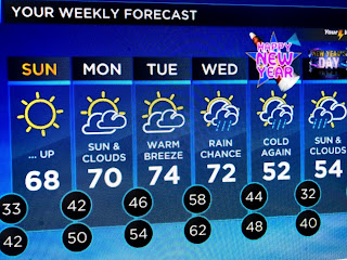
The 70s have surged into Oklahoma and we will be back to 70+ perhaps as soon as tomorrow. Look at the dew points as they still are in the 20s indicating very dry air over us. It will take some time for the south winds to bring back enough low level moisture for fog development and that probably won't happen until Tuesday night into Wednesday morning.
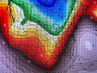
There are no signs of return flow yet as the most recent cold front has pushed down into the NW Caribbean. We'll have another chilly night (30s & 40s) but I moved my potted plants back outside so they can enjoy some sunshine and warmer temps. The cold is not gone for good. In fact look at the upper air pattern coming for New Year's.
The top graphic was this morning's upper flow with the deep east coast trough swinging out to sea. the middle graphic is the forecast for late Monday with a much weaker trough approaching. But look up into Idaho & Montana. That next dip will come down and deepen the east coast trough for New Year's Eve which is the bottom graphic. That deep a dip will once again drag down Arctic air into the lower 48 so we could be looking at freezing temps here for the start of 2021. Still have 6 days to watch it.Finally, I always like to point out features on satellite pics. Our recent cold snap brought some snow down pretty far south. All that white is snow on the ground as far south as the Georgia line. NE TN, Eastern, KY & all of West Virginia experienced a White Christmas. We still have another 2 months of cold, so you snow lovers, don't give up hope just yet. Stay tuned!


No comments:
Post a Comment