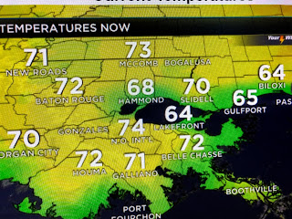
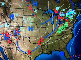
You can see 60+ dew points from Houston southward along the Texas coast. You can also see how the lake effect is keeping temperatures in the 60s around the Lake and the set up is in place for those 60+ dew points to spread over the cool water temps resulting in fog.
Otherwise there is not much to talk about since we are currently in a weather lull. A weak front will approach tomorrow and we could see a few showers along the frontal boundary which is likely to stall near us. There isn't any real cold behind the front and will will stay mild to warm into early next week. Even then, I see no threat of freezing temperatures coming back.
We were really unlucky today as the early morning sunshine gave way to an overcast sky. From Biloxi to the Florida beaches, it was a beautiful sunny day.
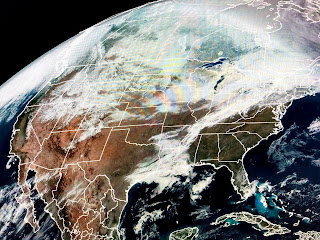
The current warm up across the South has resulted in a rapid snow melt. The yellow line is the current snow cover that has retreated almost up to Chicago.
Finally, before you think we are finished with cold weather, let me caution you about the extreme chill (35-40 below) that remains over northern Canada & Alaska. Right now, there are no signs of that coming into the lower 48 during the next 10-14 days. By then we'll be heading into mid March when the higher sun angle becomes our friend. In the short term, be on the fog watch. Stay tuned!


No comments:
Post a Comment