The main airport in Denver reported 27", but it's hard to tell looking at the Denver skyline view before and after the storm. What I loved about Colorado were the views of the mountains on a clear day.
The view of the Flat Irons overlooking Boulder and the snow on Pearl Street really doesn't tell the story until you get into the neighborhoods. Here's some views around my son's house in Longmont. Some of them are really stunning.
All is not pretty and nice if you must travel and get to works or the doctors.
This has been much needed moisture for the Front Range and they really need more snow farther west up in the mountains. Another such system will bring them more moisture tomorrow and that California system will bring us a severe threat on Wednesday.
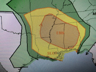
A cold front has stalled to our west and will retreat northward tomorrow as the western system approaching. SPC has highlighted a large area for the potential for severe storms Wednesday afternoon into over night on Thursday.
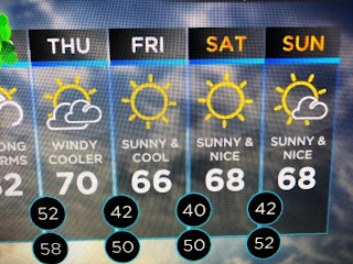
Since this next system is expected to be a fast mover, the main issue should not be flooding rains, but strong winds with an isolated tornado. Models are only showing less than an inch for the South Shore while the North Shore could get 1-2". Actually this is needed rainfall as we are several inches below average/normal for the year.


No comments:
Post a Comment