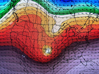
It must be a weak upper feature that triggered the storms and that is what will trigger more storms Wednesday PM into early on Thursday. Another strong upper disturbance is over California, but the energy with this system will travel on a lower latitude.
The bottom 3 graphics are the upper 500 mb flow. The 1st is from this morning, the 2nd is valid Wednesday morning and the last is valid Thursday morning. Note how much farther to the south (closer to us) the upper energy comes. That has the Storm Prediction Center on alert for a tornado outbreak late Wednesday into Thursday.
Their severe graphics have only slight chances on Tuesday in Texas & Oklahoma shifting to the east on Wednesday. They may even raise the threat higher across Arkansas, Mississippi & Alabama. We are in the slight risk area, but should stay weather aware on Wednesday.
The top graphic is the dew points that show the dry air across north Louisiana much lower than here. That front will retreat back to the north ahead of the next west coast system.
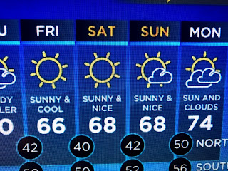
So we will remain in the warm air sector until the next front arrives after dark on Wednesday. That front will not stall and cooler and drier air filters in for the weekend. It should feel great with lots of sunshine.
Finally, everyone is talking about Drew Brees retiring. One of my regrets is never having the opportunity to meet Drew in person. He did give us many thrills & a Super Bowl, and for that we all are thankful. Reminds me of another great quarterback who was super popular back in the 70s (Jack Kemp). Nah, don't even think about it Drew! Stay tuned!


No comments:
Post a Comment