The top is the view from the lodge overlooking the Broadmoor in Colorado Springs. The next are the day before and after from Louisville overlooking Boulder & the Flat Irons. The bottom is Boulder Creek showing snow clinging to trees. Note the depth of the snow in the gutter.
Speaking of depth, at my son's (Rob) house in Longmont, he had 9-10" by 10 AM. (more now) You can see by the way it clings to backyard furniture, this is a heavy, wet "heart attack" snow. Not all is pretty.
Imagine having to clean off your truck before you head into work! No thanks. You want to see snow? Head to Colorado & the mountains.
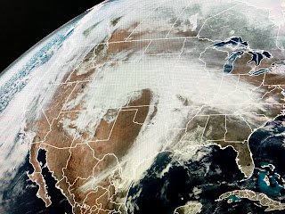
The satellite view of this storm has a classic comma shape. Much drier air is following the cold front that will stall before it reaches us.
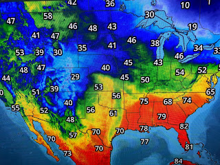
Look at how low the dew points are behind the front. That dry air won't make it here until Thursday. We could see some much needed showers on Wednesday ahead of the front as our yards have really dried out. Cooler air arrives for Thursday into next weekend.
Until then, we'll stay warm & muggy with only a slight chance for rain Monday & Tuesday.


No comments:
Post a Comment