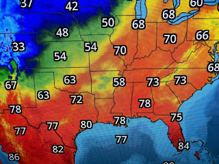
Most of the showers were north of Lake P. and our better rain chance arrives tomorrow as a strong cold front will push through. The is the potential for some severe storms on Wednesday, but the greater threat is to our NE.
We could see .50 to 1"+ rainfall but the heavier amounts are projected to be over areas between Atlanta & Nashville. The biggest change coming will be the temperature drop as much colder air will bring back sweaters and jackets.
The concern for gardeners will be the potential for frost on Friday north of Lake Pontchartrain.
This Easter weekend looks dry with a warming trend, but until the front arrives, we are feeling sticky.


No comments:
Post a Comment