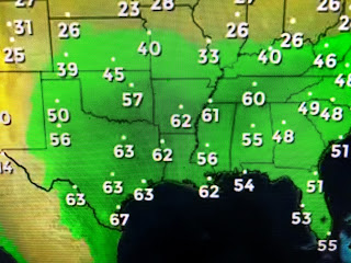
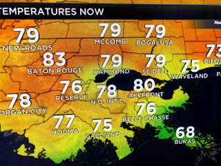
Along the boundary showers and T-Storms have been moving west to east today. As the California upper low heads eastward, snow is beginning to break out.
The collision of the airmasses coupled with the strong upper disturbance should trigger a severe weather outbreak on Saturday moving to the east on Sunday. As you can see, the greatest risk is way farther to our north. And that is where the heaviest rainfall should also stay.
In fact, the models are indicating only 1-2" amount across SE LA/MS with the 3-5" totals well north of us.
With our dew points well above 60, we are starting to feel a little Summer-like. However, we are not done with cold air. Models continue to show a cool down coming late next week that will carry beyond into the last week of March.
So those of you wanting some rain for your gardens, hope is coming next week. For the next several days, expect us to remain around 80 each day with increasing rain chances arriving by Monday.


No comments:
Post a Comment