The severe risk lessens for Friday, but notice the 7 day rainfall totals with widespread 4-5 inch amounts over a large area of LA/MS/AL. I'm thinking that those numbers are overplayed, but I wanted to alert you to that possibility IF the front stalls. We have a few showers around today mainly north & west of NOLA, a sign of things to come.
In the short term, the front is too far away to cause us any problems for Wednesday and we'll see a warm, more humid day tomorrow with only a stray shower.
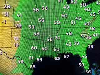
80s are all the way up to Chicago and dew points have moved into the 60s around us. Low level moisture will keep increasing as the front approaches early on Thursday.
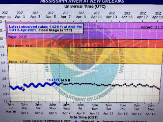
You can see the clouds surrounding the upper storm over the Rockies where it is snowing at higher elevations. We'll know better tomorrow whether the upper system will provide the push necessary to get the cold front through us and not have it stall. Finally, the NWS River Forecast Office has LOWERED the crest coming down the Mississippi.
Unless there are more heavy rains during the next 2-3 weeks farther north, all indications are there will be no need to open the Spillway this year, and that is good news. Stay tuned!


No comments:
Post a Comment