The top graphic is today's slight risk area with the middle valid for tomorrow. Note it's 81 in Minneapolis while we're in the mid 70s. That's because we're still enjoying the effects of the large coold high pressure that made for a delightful weekend. As the high shifts off the east coast, low level moisture/humidity is streaming northward on the backside along with warmer air.
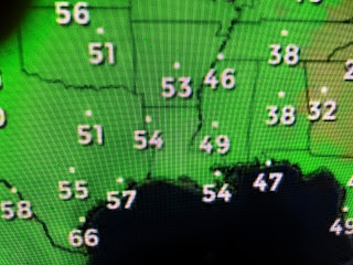
Dew points in the 40s still cover the North Shore, but 60s are showing up in south Texas. That's what's coming here for the rest of this week. We could see a few showers tomorrow during daytime, but the better shower chances arrive late Wednesday into Thursday with a weak front.
I don't see any strong cold fronts returning, but we'll still have the opportunity for "drier" fronts for the next 2-3 weeks. Satellite views have some cloud clusters with minor upper disturbances with the strongest over Idaho crossing the Rockies. The energy with that system will stay well to our north, but it should bring us a weak front near us later this week.
Finally, once we get 4-5 days with no rain, buda bing, the fires are back. Can't believe these are anything more than the burning of storm debris, but the shear number ( I counted 23) is one possible reason for the hazy skies from Texas to the East Coast. Stay tuned! FYI I remain blocked from posting on my FOX 8 Fan page, but hope I'm unlocked soon.


No comments:
Post a Comment