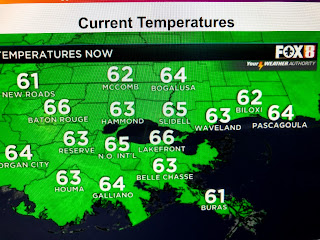
Clouds have been pushed well off the Louisiana coast and we will stay dry for the next 5-7 days.
The surface map has the center of the large high moving down over the Great Lakes with really cold air sinking deep into the South. This is extremely dry air with dew points in the teens & 20s. You may need to protect any tender plants on the North Shore for the next 2 mornings as lows will dip into the 30s.
The 70+ degree waters of Lake Pontchartrain will keep the South Shore in the 40s. We begin a warm up on Saturday that continues into next week. But we are not done with cold fronts.
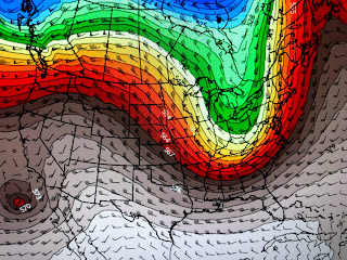
the top graphics is today's upper wind flow with a deep trough over the eastern states bringing down the Canadian chill. The middle graphic is valid next Tuesday showing the trough lifting out with a west to east warmer flow. But the bottom graphic is valid for the following Sunday showing another big East Coast trough developing. That should bring more fronts so the heat of summer remains many weeks away. Finally, we all know how wet its been over the SE with the recent Nashville flood. But did you know how dry it's been west of the Mississippi?
Notice how clear it looks over the SE with no signs of any fires. The bottom view has a number of fires in Arkansas, Missouri, Oklahoma & Kansas. You can see the haziness look with all the little white dots current fires. that's where rain is needed, but I see none coming during the next 5-7 days. Get out and enjoy our good feel air. Stay Tuned!


No comments:
Post a Comment