I'm seeing 3 weak upper features (yellow lines) that are trying to move into the eastern upper high. The feature over us brought lots of mid & high clouds today, but no rain. Just to our west, radar is seeing showers & Storms firing off ahead of the middle disturbance.
The stronger action remains west of Houston, but some showers have leaked into western Louisiana this afternoon.
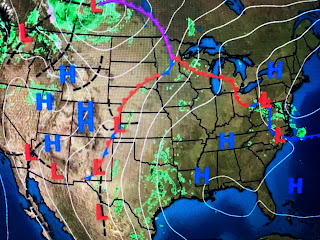
The surface high remains centered near Atlanta where temps topped 90+. A back door cold front has brought some relief to the NE, but the warm Summer-like air has risen into southern Canada.
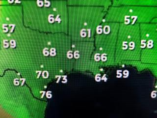
Still, the air hasn't felt "gawd awful" yet and that's partly because of the cloud cover & the slightly lower dew points. Note how 70+ dew points are just to our west and we should see humidity creep up during this week.
We do have a slight (20%) chance for a shower on Wednesday as that weak upper disturbance over Texas approaches. By the weekend as highs near 90, we'll see a couple of pop up storms during daytime heating typical of late May & early June. With a full moon arriving tomorrow night, I suspect termites will again be swarming after dark. Ahhh, Summer in Da South! Stay tuned!


No comments:
Post a Comment