


The 2 areas that NHC is following are Claudette and an area approaching the Islands in the Atlantic.


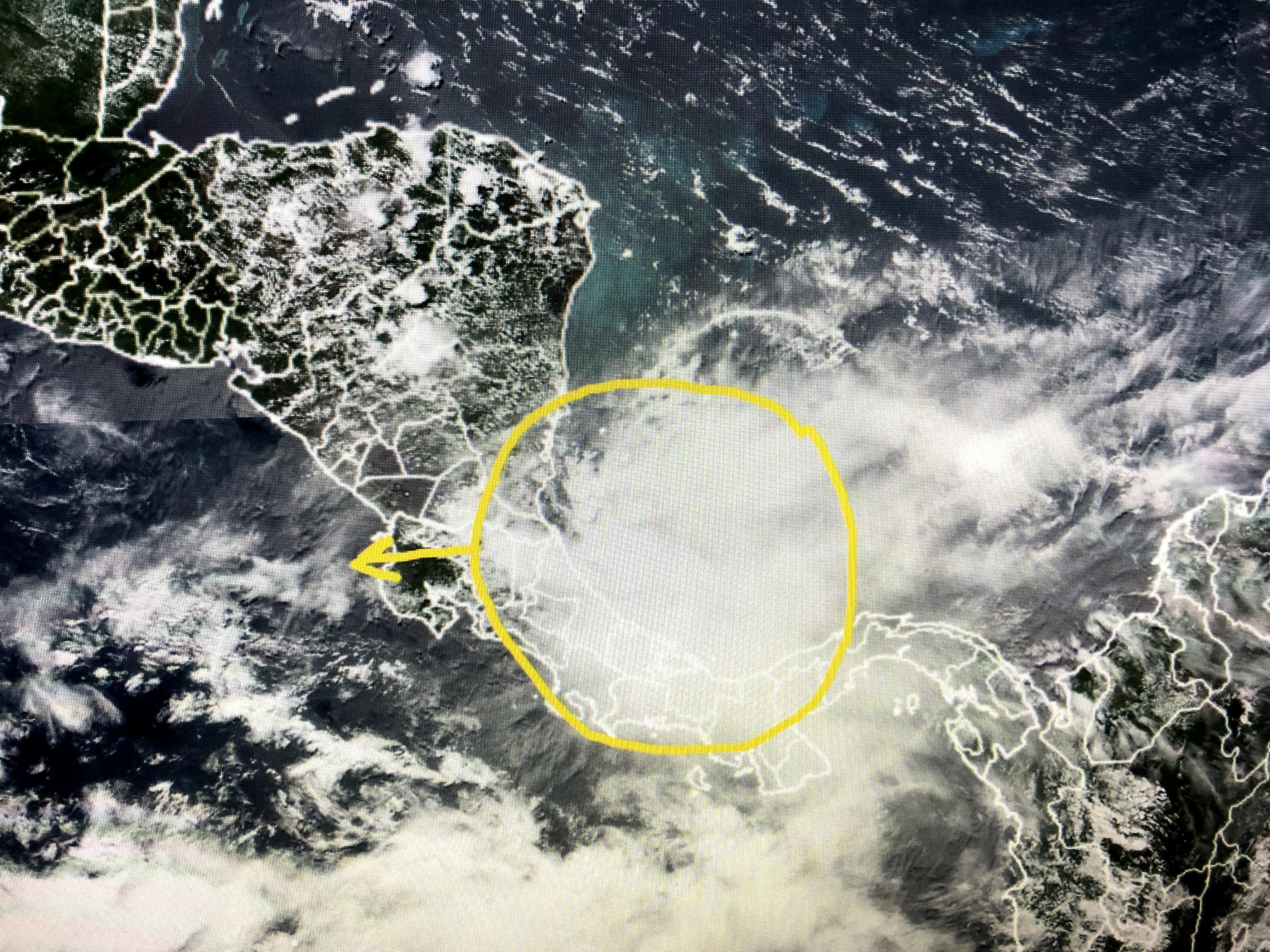
They give the Atlantic wave a 30% chance to develop, but I don't see models doing that. Another cluster way down in the Caribbean is moving into the Pacific and NHC thinks that might develop.
Locally, a burst of storms has developed over the northern Gulf.

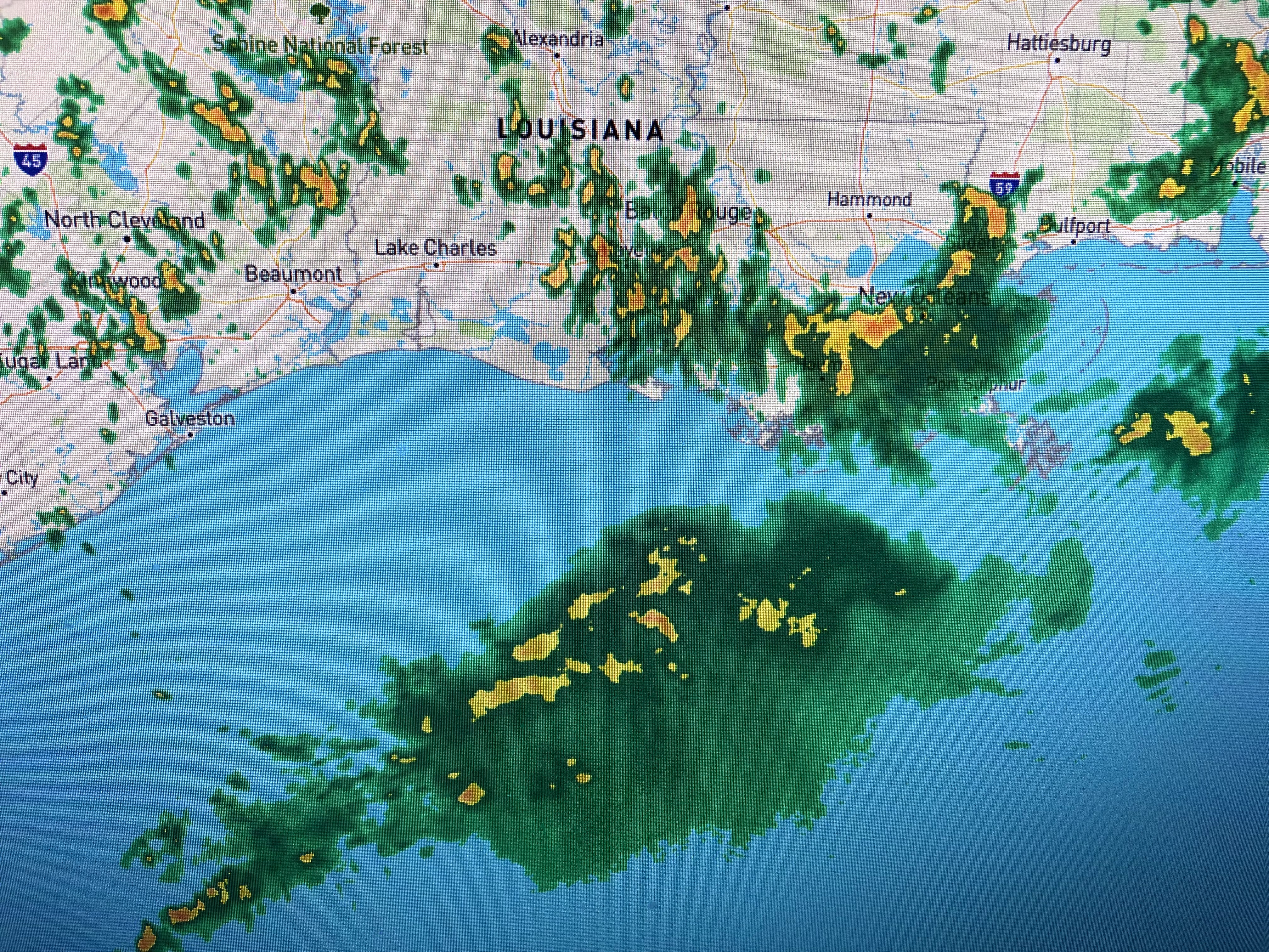
The storms associated with it should stay off our coast, but a band of storms has set up right over the South Shore prompting flood warnings.


If you don't need to drive during the next 1-2 hours, best stay home as street flooding will swamp cars in the usual low places. Unfortunately, another frontal boundary will aid in forming more storms tomorrow and Wednesday.


This is a fairly strong front that will probably run out of gas as it reaches south LA/MS. It would be nice to see it push through as dew points (drier air) are much lower behind this front.


The rain has cooled many spots this afternoon however, no cooling is expected to reach us with this next front. Finally...

The GFS (American) model continues to place a Tropical system in the Gulf by July 1st. Yesterday it was over the western Gulf while today it has it east of Mobile. The Euro doesn't have it yet. Long time to watch. Stay tuned!

No comments:
Post a Comment