


I feel OK if you choose to stay provided you have the above. 1) Elevation or a two story house in case the levees fail. 2) Fully functional shutters, Window protection to keep the wind out. And, either a portable generator or full house general in case power is out for days or weeks. If you don't have all 3, then the decision is already made for you. You must leave as you don't want to put 1st responder's lives at risk trying to rescue you and your family. If you must leave, know where you are going (friend or relative far away from the water) and how you will get there. There's a lot more work involved in staying (adequate food & water) than in leaving. However, Leaving is way more expensive and that often becomes a factor in decision making. Bottom line, the discussion regarding what you'll do needs to be made way before a storm threatens.


NHC has increased the area down over the Bay of Campeche to 50% probability for development later this week. The area off the South Carolina coast is associated with a leftover frontal boundary and will race away from the U.S.

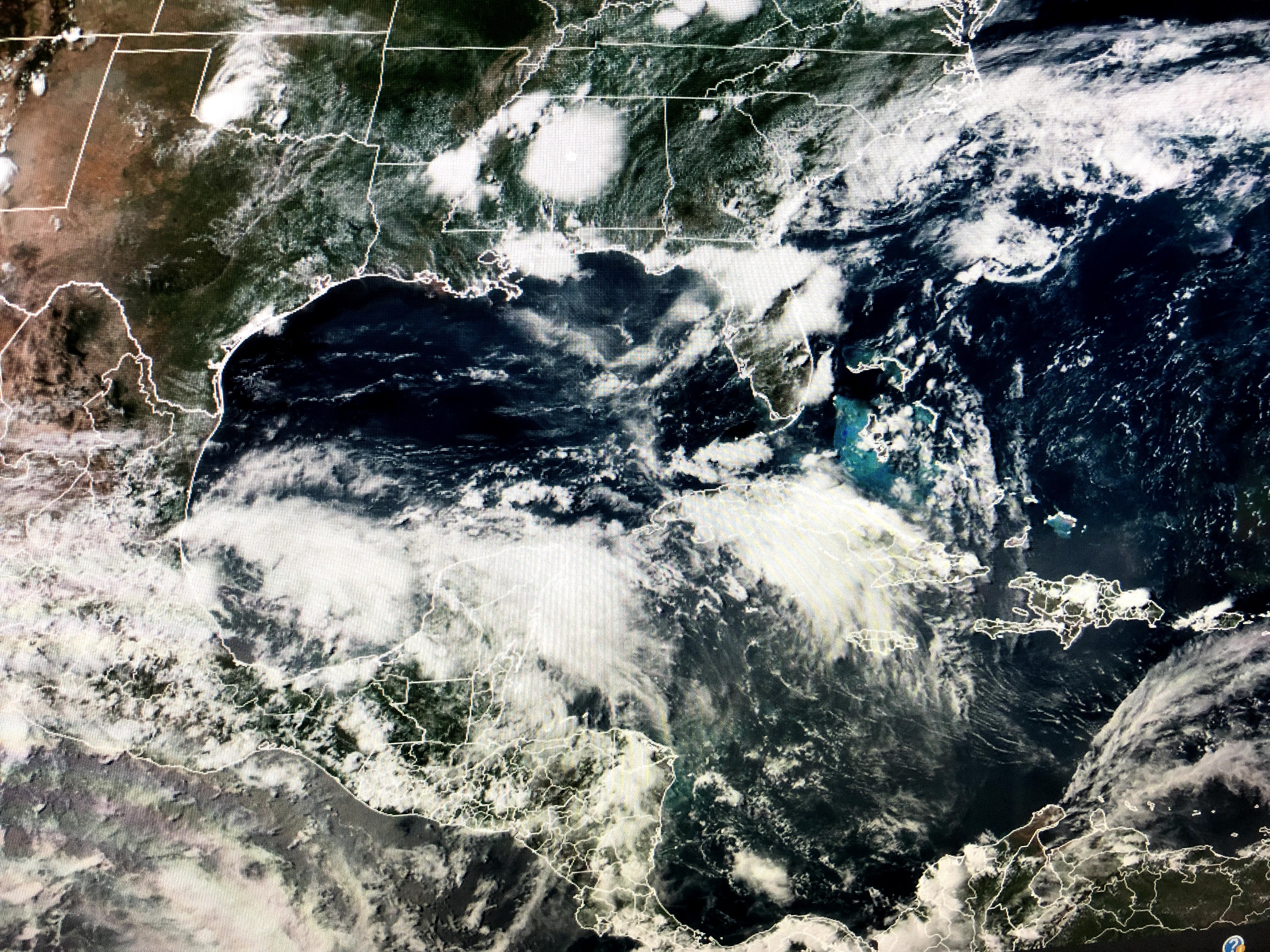
Down over the Gulf, a large disorganized mass of clouds is not called Invest 92. The computer projection basically keep it down there for the next several days, however, the 7 day rainfall totals continue to hint that heavy rainfall will head northward for next weekend.


The main models continue to show a broad low will drift toward the northern Gulf late this week.


A severe T-Storm Watch is in effect for the North Shore in addition to coastal waters. Look at how these storms have brought cooling relief to the Mississippi coast.


As the 7 day shows, little change until Friday into next weekend. As I said yesterday, whatever forms will bring a heavy rain impact to many folks. Too soon to lock in on a location. Cerrtainly SW Louisiana (Lake Charles/ Lafayette) doesn't need another storm, and neither do we. Stay tuned!

1 comment:
Thanks Bob for the level headed and well thought out insights.
Post a Comment