


What might happen is an area in the eastern Pacific develops into a TD or TS and it moves northward towards the southern Gulf.


It would weaken as it moves over land, but the leftover energy could be what triggers development in the Gulf. Both the GFS & Euro try to do just that.


The top graphic is the GFS valid for late next Thursday with a weak low south of the mouth of the River. The bottom is the Euro having a broad low farther to the west south of Lake Charles. My take? Way too early to believe either model has the correct position & intensity. As I did yesterday, I just wanted everyone to know there MIGHT be something in the Gulf for later next week. Typically, June storms are weak, however Major Hurricane Audrey clobbered SW Louisiana during the last week in June in 1957. That is why we pay attention.


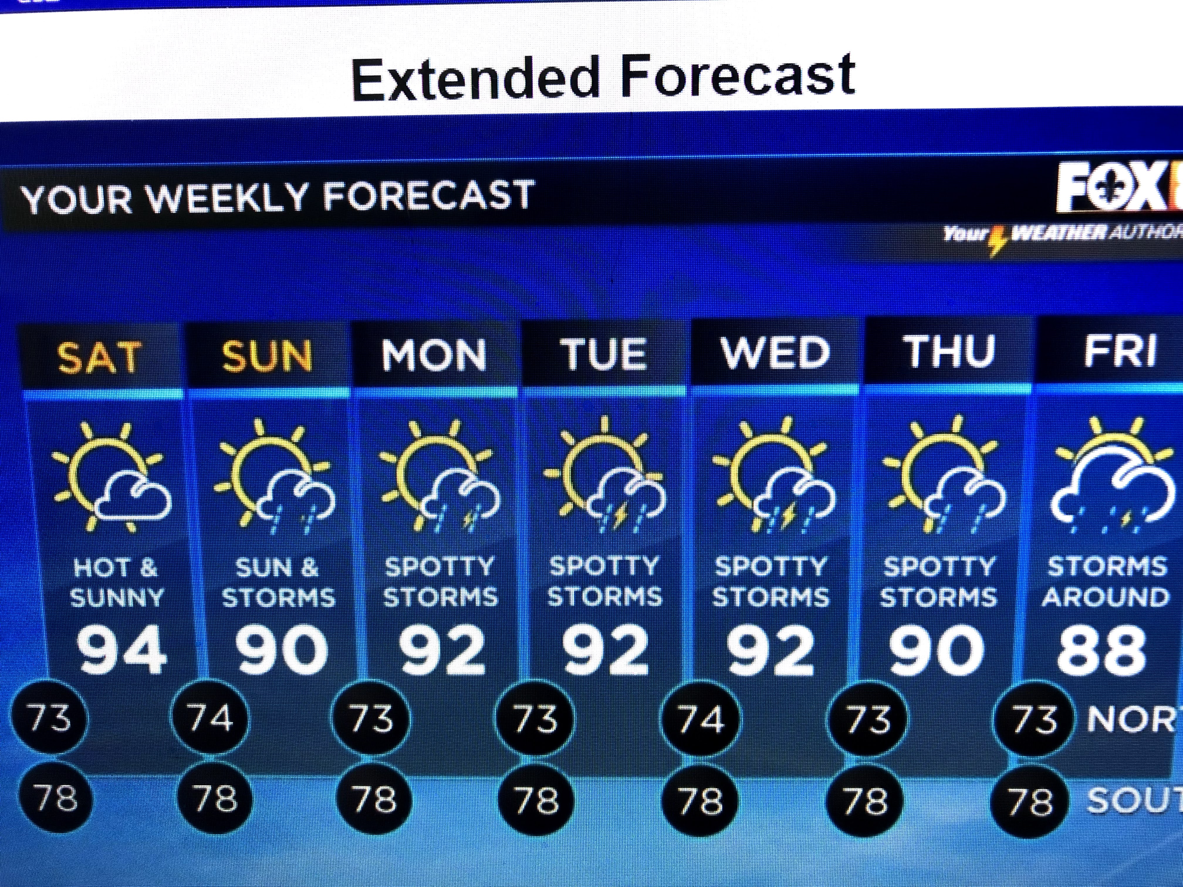
Locally we have a quiet afternoon with all the storms far to our north and east. An upper high is bringing the hottest temperatures so far this year here and back to our west.


Look for more of the same on Saturday before rain chances increase Sunday ahead of a weak front that will try to "back door" its way into us from the NE.


At this time of the year, don't expect any drastic temperature changes as the only cooling relief usually comes from daily showers and T-Storms.
Tomorrow I'll go over what most of you already know. What kind of a plan do you have in case a storm threatens Louisiana? What would you do when the next storm comes? Do you stay or leave? I'll give you some guidance. Stay tuned!

1 comment:
Thanks Bob.
Post a Comment