The top graphic is the GFS showing a closed circulation east of Corpus Christi with the middle being the European model indicating a less robust system, but still over the same area. The bottom is this afternoon's satellite view showing lots of disorganized clouds, especially over the southern Gulf. I'll watch to see if the models continue this trend or if it becomes nothing but a tropical surge of moisture.
Locally, we have been mostly dry with a thin band of showers north of lake P. A strong cluster of storms is north of Monroe moving to the SE. Without any rain, highs have been back to 90+ today which is typical of mid June.
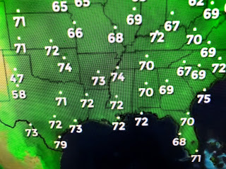
This Summer heat feel is shared by many across the U.S., but much of the Northeast has seen a drop in their dew points making it feel much better.
Even though we have low level moisture/humidity at the surface, an upper high over Texas is steering most of the storms to our north and east. We have reached the time of the year when the 7 days becomes almost useless.
Hot, humid with a spotty storm. Yawn! You want to be cooler? Fly to Missoula! Stay tuned!


No comments:
Post a Comment