

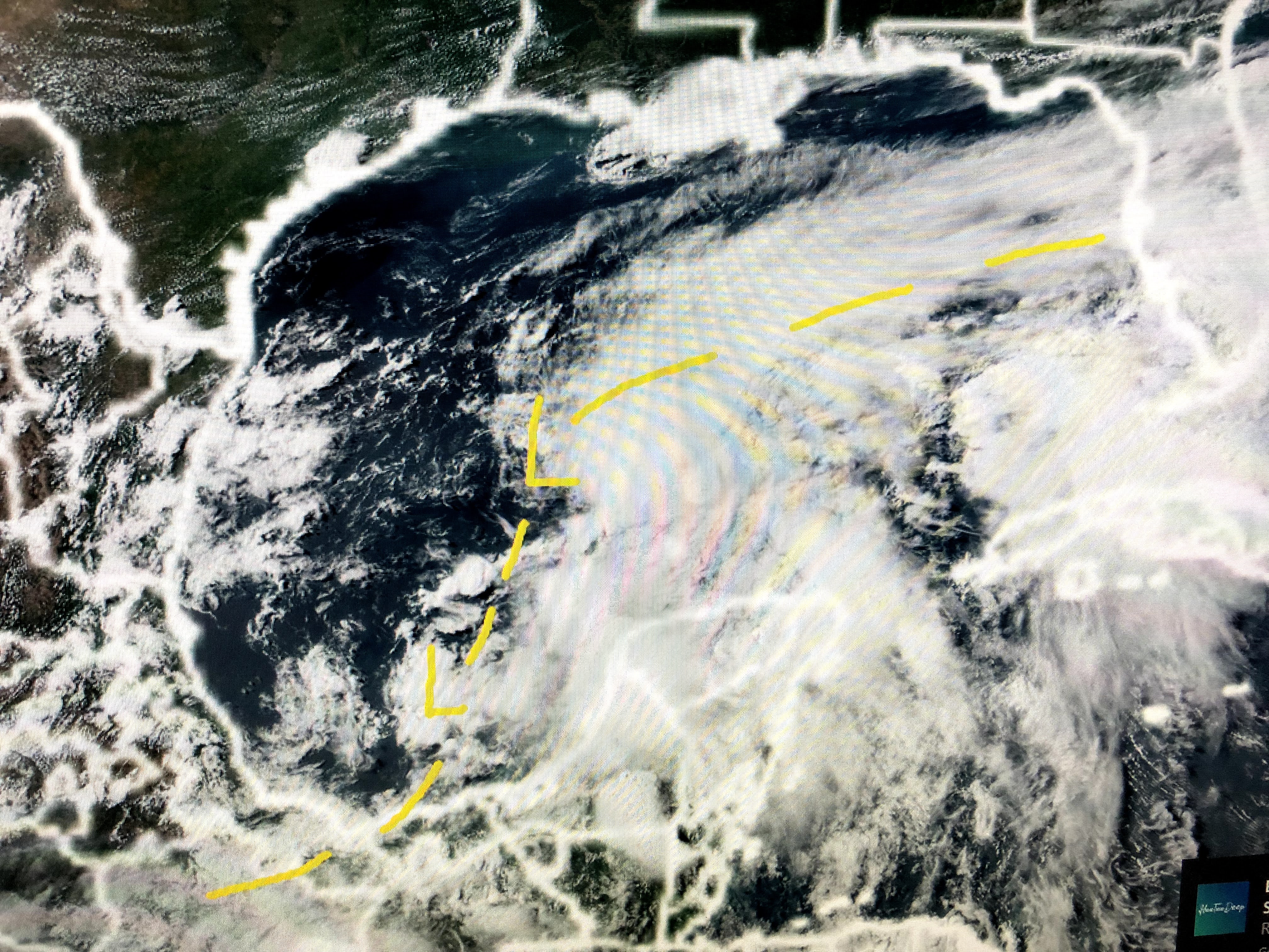

The top picture has an old frontal boundary draped back westward from the Atlantic into the Gulf and then back into the Pacific. The middle view has the dashed lines marking the boundary from drier air and the deep tropical moisture. The two Ls mark where an UPPER low is located. Right now, the atmosphere over the Gulf is a semi-hostile environment and I would not be surprised if NOTHING (Depression or Trop. Storm) develops. Look at the latest models.


The top three graphics are the GFS, Euro and Canadian models valid for midday on Saturday that all indicate mainly an open wave or inverted trough. That would indicate wind impacts should be minimal. However, Bruce Katz showed the wind gust forecast model indicating gust 40-50+ for Saturday. So what can you believe? Here's a nugget from today's National Hurricane Conference.


NHC Director Ken Graham (Former head of the NWS in Slidell) said "computer models handled the stronger, well fined storms of 2020 very well, but they struggled with the "genesis storms (newly formed) or the slow movers". The current Gulf system is in the "Genesis stage" implying great UNCERTAINTY in model outputs. What I can say at this early stage is we are near 100% sure this will not become a major storm, but more likely a brief heavy rainmaker for someplace (maybe to our east?) along the northern Gulf. A Hurricane Hunter aircraft is scheduled to investigate tomorrow afternoon. Maybe then we'll know if a surface low has formed. For now we wait.


Our big local weather news is the drier air that has sunk into south LA/MS. Look at our dew points in the 50s & 60s! Along that boundary some clouds and showers have developed, but most have stayed offshore.


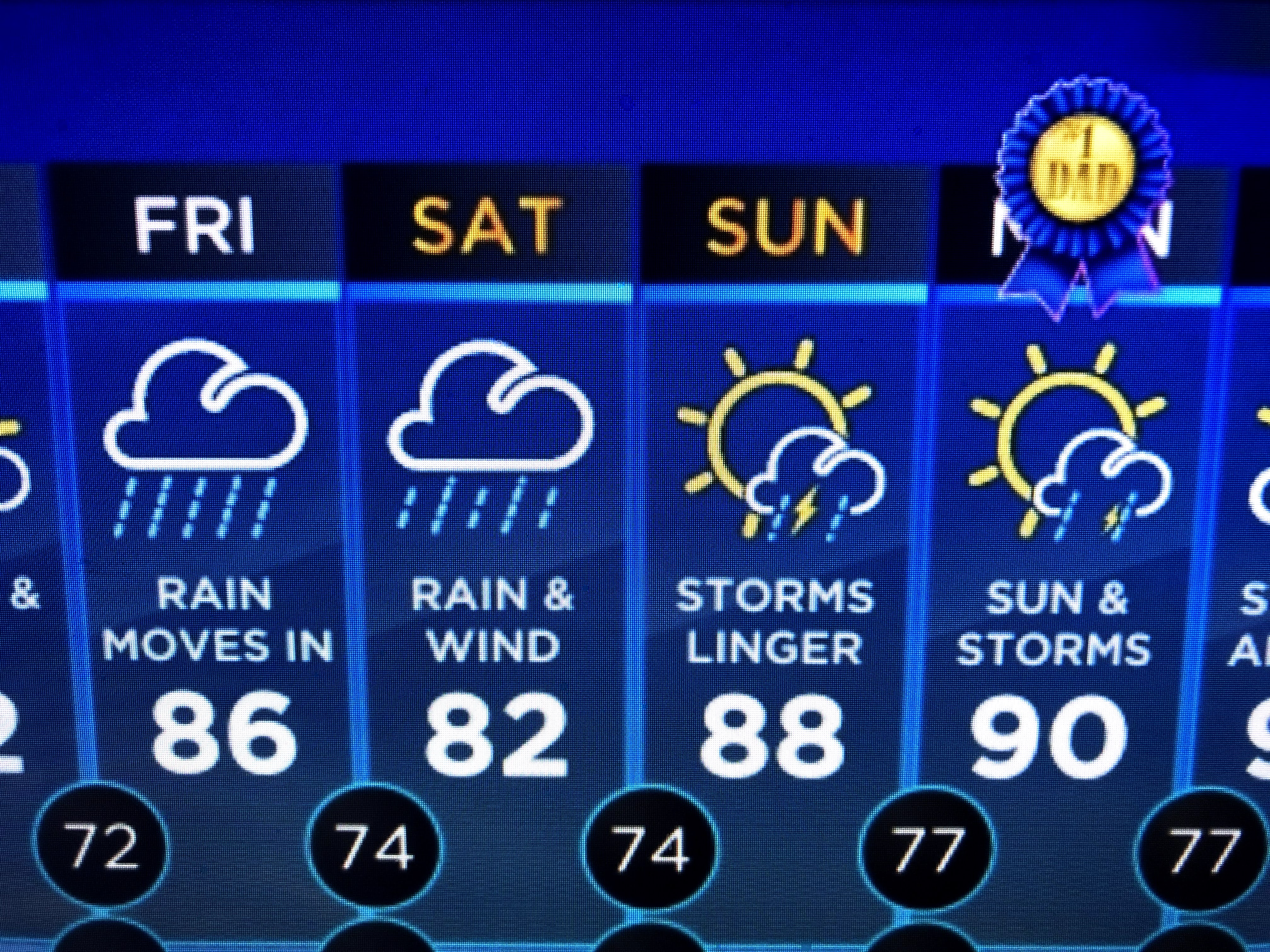
So Thursday should stay mostly dry with rain chances increasing by Friday afternoon. Saturday looks to be the rainiest day IF whatever forms goes to our west. IF nothing closes off, we may just see a surge of tropical moisture move in and out especially by Sunday PM. As usual, we'll keep watching and will let you know if you need to worry. I'll have more regarding the Hurricane Conference tomorrow. Stay tuned!

5 comments:
As always, Thank You Bob!
Thank you Mr. Breck for all of your time and efforts. My family truly appreciates your input. Have a blessed day!
Thanks Bobby
Have you ever thought about doing this on YouTube live and getting paid again with ads and donations?
I can help and I wouldn't charge a penny.
I want to watch your accurate weather reports again
Thanks Bob.
It sucks that N.W.S. won't let the news give their honest opinion anymore.
I miss your accurate weather reports on ch8 but I'm glad I found you here.
Post a Comment