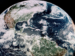
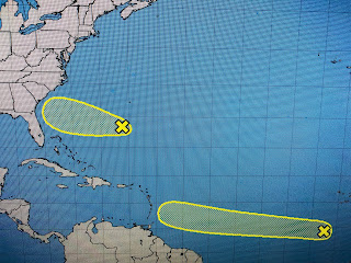
The circle in the eastern Pacific is Hurricane Enrique with the one in the Gulf an upper low and the one SE of Bermuda as surface low and the circle off Africa being designated 95 L. Early model runs keep it out of the Gulf and it's way too far away to worry about. So let's look closer to home where NHC has indicated an area off the East coast has a slight (10%) potential.
The upper low over the Gulf is quickly moving toward Texas and we'll get on the wetter side of it tomorrow. It should not develop, but the other two could.
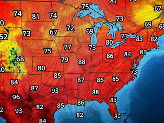
This is a typical summer weekend across most of the U.S. with Gulf humidity streaming up to Canada. We saw fewer showers today but should return to scattered storms on Sunday.
The brisk SE winds made today feel not so bad as we know the dog days of August are coming.


1 comment:
Hey, Bob.....I gotta ask, how old is Bailey getting to be?!
Post a Comment