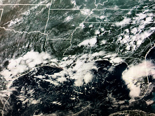
Simply put, at this time of the year, there is a semi-permanent feature on the SURFACE weather map (Bermuda High/Atlantic Ridge) that has the nose (axis) of the high extending westward over the SE United States. That nose/axis shifts northward or southward creating subtle differences in our weather. If the axis is north of us, we get SE to NW moving T-Storms that bubble up during daytime heating. If the axis sinks to our south, the storm motion becomes SW to NE. What has happens for the past few months is the nose of that Ridge has been backed out into the Atlantic (Why Elsa made the turn around the nose over the eastern Gulf) with an upper tough along with lower surface pressures over us that promotes above normal clouds and showers. But since I retired, NO ONE uses the surface map any more. All you will see are model forecasts with very little storytelling as to why the weather changes, and that is a shame. I expected someone to point out how much higher the surface barometer readings have been, but noooo. There, I've had my rant for the day. Back to what is going on.
Way out in the Atlantic, NHC has highlighted an area that has a small swirl of clouds, but no storms around it. It is not our concern. The Caribbean & Gulf remain quiet.
We have no fronts around so our daily storms are triggered by daytime heating and/or the interaction of the land/lake breezes. The next couple of days should see very little change with a slight uptick in shower chances next week. The other big weather story is the western fires.
You can clearly see the smoke/haze on satellite views with the biggest fire roaring in Oregon. Some storms have developed over Nevada, Arizona new Mexico & Colorado bringing welcomed rains, but those storms also bring lightning which can ignite new fires. It's going to be a long summer out west. If only we could give them some of our rain? Stay tuned!


3 comments:
Bob
I love your discussion of the underlying
principles of the Bermuda High. You are
right the good drawings that you used to use
are somthing that is really missing to understand
weather.
I appreciate the time you take to explain weather, I love weather and knowing more is good. I don't understand why most weather forecast today amounts to a 5 min talk fest with little to no explanation to the "why's" . I don't even bother watching weather on TV anymore.. God Bless
Those days are gone sadly. I used to love watching you explain the science behind it. I miss this
Post a Comment