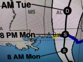
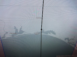
NHC quickly upgraded Fred back to a Tropical Storm and he should continue to strengthen today becoming a strong T,S. before landfall. Satellite and radar views clearly show Fred to be "east side loaded", meaning the heaviest winds & rains will be to the right (east) of his center line track. Here's the 10 AM updated track.
At 4 AM the center line was over Pensacola and now it's shifted farther to the east over Destin. The worst part of Fred will be east of that centerline meaning the MS/AL coasts should see minor impacts with the stronger wind & heavier rains from Pensacola eastward.
Elsewhere, I circled the 4 areas that have some swirls with them. The new area north of Bermuda is an old low pressure area that moved off the East Coast along a cold front. It is drifting to the south where the waters are warmer and it has a slight (30%) chance to develop. Tropical Storm Grace continues to struggle as she churns westward over the Caribbean. Her track is following Fred's and that would take her over the mountains of the Dominican Republic and Haiti. Since she remains weak, her circulation might become disrupted like Fred's.
Note on the colorized IR pic how disorganized the clusters of storms are. One scenario that could happen is the ill-defined center of Grace passes south of Hispaniola and misses the mountains allowing her to get stronger. The 10 AM NHC's forecast track should be taken knowing models struggle with weaker storms and the center line becomes less important with the cone becoming our focus.
There has been a slight shift to the south (left) in their center line track. yesterday the center line was right for NOLA while today it is aiming towards Houston & the upper Texas coast. Plenty of time to watch it. For now, Fred is our focus. Stay tuned!


No comments:
Post a Comment