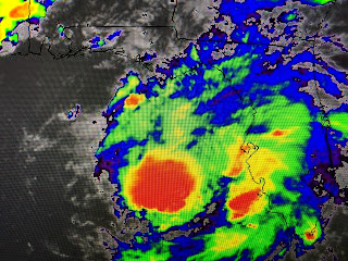
Note on the colorized IR how storms have become more concentrated. I'm guessing at where the center is, but no fear since we have the Hurricane Hunters flying in & around pinpointing the center's location.
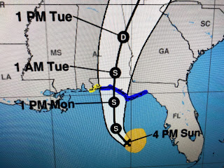
NHC has again nudged the track farther to the east now center lining over Seaside/Sea Grove Beach.
The top graphic is the arrival time of tropical storm force winds while the radar still has Fred right side loaded. However, you can see some heavy banding on the north side that may wrap around the circulation before landfall. Fortunately, Fred is expected to keep moving inland and should be gone by Tuesday PM.
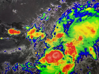
Elsewhere in the Tropics, there is a well defined low north of Bermuda that may become Henri since it's drifting over warmer waters. Tropical Storm grace continues to struggle as it heads south of Puerto Rico.
You can see the banding with the Bermuda disturbance while look how disorganized Grace is. Knowing that she's remains weak and ill-defined, take the NHC's track with not a lot of confidence.
Much of her future track takes her over land masses and she may not survive before reaching the Gulf. We have all week to watch her.
Our local shower/storms have nothing to do with Fred. They have popped up during daytime heating and some will be back tomorrow. Next update around 10 PM. If you're in Mississippi and Alabama or west of Pensacola, the brunt of Fred will miss you. Those to the east, be ready for Freddy. Stay tuned!


No comments:
Post a Comment