

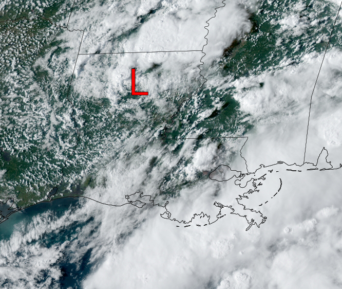
A lot of drier air has rotated around Nicholas with the heaviest storms NNE of the center and along the LA/MS coasts.


There is the possibility that the band of heavy rains along the coast could move back over us, so NWS is keeping the Flash Flood Watch in effect through Sunday. If we're lucky, that band will stay to our south & east with only the typical pop up storms bubbling up during daytime heating.


In the Tropics, NHC named the 15th storm (Odette) off the East coast. It is heading out to sea and will affect no one. The other disturbance that should become Peter is way out in the Atlantic so we need not talk about where it might go.

Saving the best until last, we still have another 4-5 days of hot & humid weather to endure, but the long awaited REAL cold front is coming on Wednesday sweeping away the humidity and actually making us delightfully cool into next weekend. October is almost here. Stay tuned!

No comments:
Post a Comment