Some spots on the North Shore could even see some upper 40s north of Bogalusa/Popularville. Mornings will have that crispy cool feel with afternoon highs staying in the 70s.
Sunday, September 19, 2021
Real Relief Heading Our Way...
The main things all the repairmen & women need right now are no rain and cooler temperatures. Rain coverage won't be zero tomorrow, but any showers/storms should be fewer in number, but temperatures will still be way too hot. However, a REAL cold front will arrive late Tuesday night sweeping away the humidity and bringing noticeably cooler temps, for the rest of this week.
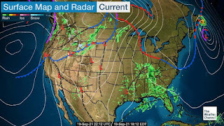
You can see the colder air spilling down over the northern Rockies and it will drive towards the Gulf pushed by a deepening east coast upper trough.
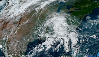
We haven't totally gotten out of our rainy pattern yet, as radars still show spotty storms over land and clusters of storms off the LA/MS coasts.
This deepening trough over the eastern states guarantees any tropical activity will be blown far to our east. In fact, all of the Newly named storms are projected to stay way out in the Atlantic.
These are the kind of tracks we hope to see for the rest of this year.
Subscribe to:
Post Comments (Atom)


No comments:
Post a Comment