Today is the last full day of Summer as the Autumnal Equinox begins at 2:21 PM on Wednesday. MSY topped 91 before some showers brought brief cooling relief this afternoon. Tomorrow the cooling relief will be a REAL cold front that will push way down into the Gulf giving us a delightful stretch of weather into the Weekend.
The front that will bring us cooler temps and much lower humidity is approaching Shreveport and will sweep through after midnight.
There might be a few showers with the front, but for the next 4-5 days, we should be sunny, dry with comfy cool mornings and very pleasant afternoons. The muggies return by next Monday.
You can see about 30% shower coverage this afternoon with cooler temps where the clouds and rain are while it's 90+ in the sunshine. I don't see a return to 90+ for the next 5-7 days/ We still can see 90+ in early October, but the lower sun angle and longer nights begin to take their toll.
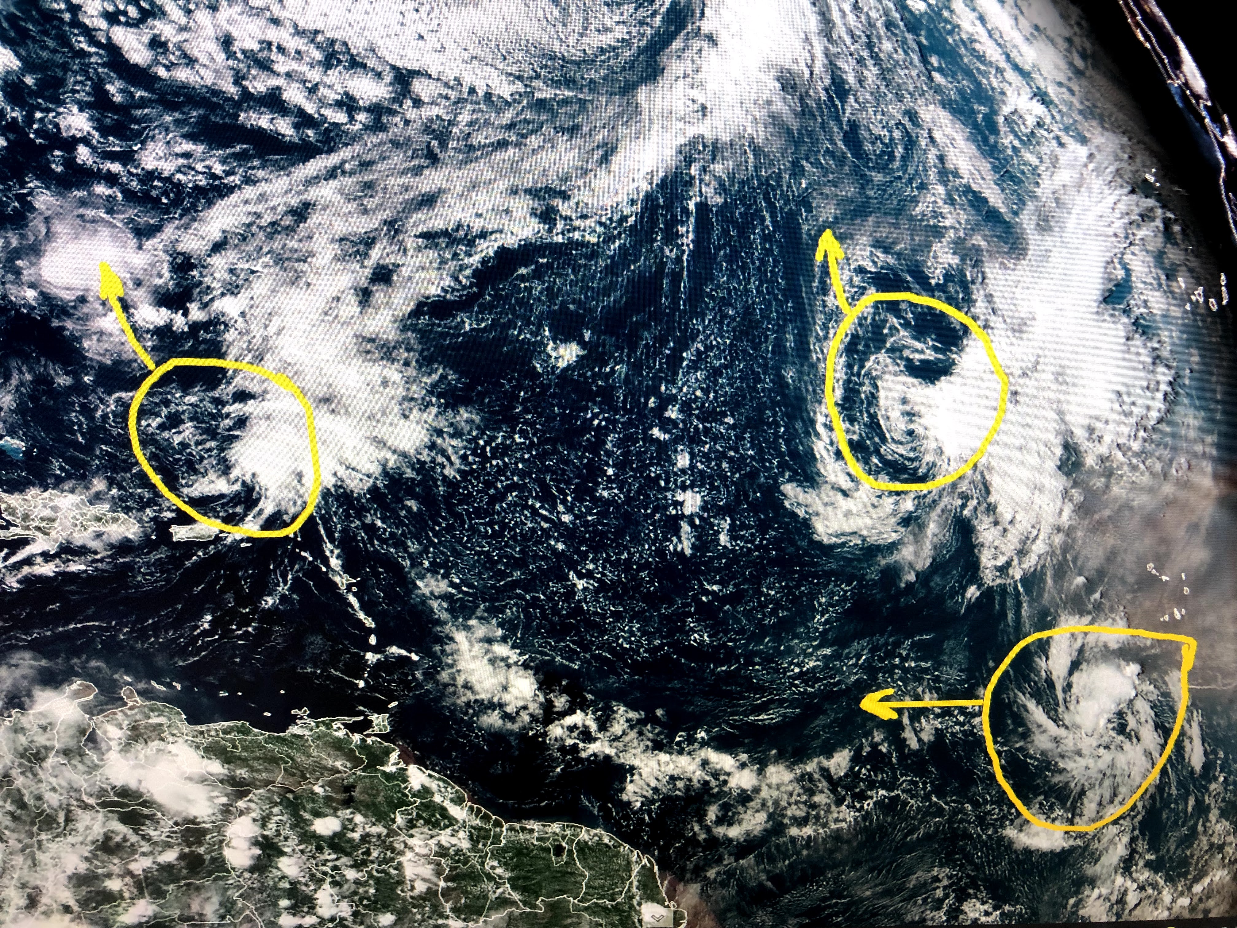
The Tropics remain active, but not around us. Two useless named storms (Peter,Rose) are struggling out in the Atlantic, but it's the disturbance coming off of Africa at a lower latitude that might be the one to watch. The GFS turns it northward away from land, but note the bottom graphic is the Euro which brings it towards Puerto Rico. We have many days to follow it but it will be named Sam shortly. Let's enjoy the cold front Gang! Stay tuned!


1 comment:
Since we are starting the season of the fronts I wonder; why do north/south oriented cold fronts seem worse than those oriented east to west (tornados)?
Post a Comment