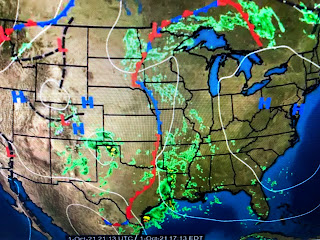
It is cooler under the upper low out west, but look at the warmth streaming northward into Michigan. Until the upper trough reforms over the eastern states, don't look for any real colder air coming in the near term.
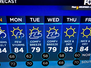
Satellite views are not encouraging regarding weekend sunshine. There will be some rainy periods, but there should also be many dry hours. Yesterday's rainfall at MSY has now pushed us to # 5 wettest year all time.
With more rain likely this weekend, and nearly 3 months left in the year, we should easily move into the # 2 position. 1991 should stay the wettest year ever as I can't imagine getting 20+" during the next 3 months.
The Tropics still have Cat. 4 Sam and Tropical Storm Victor way out there, but there is no indication of any tropical development in the Gulf or Caribbean for the next 10-14 days. I have placed a call into the "Fat Lady" to see how available she is around the 15th. I'll be more conservative getting her on stage this year since Zeta burned me last October. But it's only a matter of time Gang. Stay tuned!


No comments:
Post a Comment